
Plan period 2021 – 2039
Published by Oving Parish Council for Submission consultation under the Neighbourhood Planning (General) Regulations 2012 as amended.
1. Introduction
This section explains the background to the Neighbourhood Plan
2. The Neighbourhood Area
This section describes the designated area covered by the plan.
3. Planning Policy Context
This section relates the plan to the National Planning Policy Framework and the planning policies of Chichester District Council as the local planning authority.
4. Community Views on Planning Issues
This section explains how the community has been involved in the process of developing the plan.
5. Next Steps
This section describes the process that will be followed to proceed to the referendum stage.
6. Vision, Objectives & Land Use Policies
This is the core of the plan. It includes the Vision and Objectives which were consulted on in the spring of 2021. And it provides details of the policies (in bold type) which are proposed to address the objectives and other related issues.
7. Appendices to the policies and community engagement
8. Maps
9. Evidence base
Purpose of the Neighbourhood Plan
What the Neighbourhood Plan can do for Oving parish
It will ensure new houses wherever built:
• fit in with the local landscape,
• protect important views
• in style and design embody the local vernacular.
It will ensure new developments and special sites provide affordable houses for local residents.
It will support productive employment, backing development that:
• Enhances and regenerates existing sites
• Provides modern commercial premises and flexible work space
• Encourages higher employment density
• Helps create higher wage local economy
It will encourage developments that:
• Support, develop and enhance community facilities particularly in Shopwyke and Oving village
• Protect local green spaces that are special to the community
The plan will seek to integrate the different rural and suburban sectors:
• Protecting the individual identities of settlements
• Safeguarding landscape gaps
• Building connectivity across the parish with cycle and pedestrian routes
1. Introduction
In November 2020 Oving Parish Council decided to take advantage of the Localism Act 2011 and make a neighbourhood plan. In developing the plan we have followed the procedure set out in the Neighbourhood Planning (General) Regulations of 2012 (as amended).
The purpose of a neighbourhood plan is to give local communities such as parishes, the opportunity to influence the quality of development in their areas. Many parishes in the district have developed neighbourhood plans.
A steering group was formed of volunteers from the village and hamlets of the parish, from different walks of life, some in employment, some retired, but all sharing a desire to help shape the future of the parish.
As chairman I should like to pay tribute to all members of the group who, drawing on their knowledge of the parish, many of them long term residents, have contributed so richly to the research and decision making that has underpinned the policies of the plan. Our thanks also to Mandy McPhail, webmaster of Oving Parish website and editor of Oving District News.
We have greatly benefited from the encouragement and guidance of Chichester District Council at the different stations along the way.
Stephen Quigley
Chairman, Oving Neighbourhood Plan Steering Group
November 4, 2025
Members of the Steering Group
Katie Akerman * (Shopwhyke)
Colin Buchanan (Oving village)
Dominic Akers-Douglas (Shopwhyke)
Rod Hague * (Oving village)
Cllr Simon Oakley ( County Councillor)
Stephen Quigley (chairman) * (Merston)
John Pitts (Woodhorn)
Clive Sayer (Oving village)
Mandy McPhail * (Oving village) For part of the time
Paul Kopecek (Merston) For part of the time
Victor Davey * (Drayton) For part of the time
• Parish councillors during the process
2.The Neighbourhood Area
A neighbourhood plan has to cover a defined geographic area. It can be a whole parish or just part of one. It can cover part of an adjoining parish. Oving Parish Council considered the option of just one part of the parish but decided at its meeting on February 11, 2021 the best result would be obtained by covering the whole parish. Accordingly the parish council applied to the District Council with arguments in support for the whole area of the parish to be designated the Neighbourhood Area. This designation was registered on March 8, 2021. See Evidence Base.
Profile of the parish
Oving parish consists of the villages of Oving and Merston and the hamlets of Drayton, Colworth, Woodhorn and Shopwyke. It occupies 14 square kilometres. It is bounded in the north and west by the A27 trunk road. The southern part is traversed by the A259.
At the March 2021 national census it had a population of 1717 with a mean age of 37 years and eight months.
There have been a number of major new developments in the last 20 years in the centre of Oving village and at Shopwyke.
The parish is situated in a coastal plain that in places is subject to flooding. A feature of Oving village is that it is surrounded by green space. The landscape is characterised by large open arable fields with straight drainage ditch systems, and a low density of hedgerows and hedgerow trees.
Gravel extraction in the western part has left a number of lakes inaccessible to the public. Many parts of the parish enjoy views of Chichester Cathedral and the South Downs. Part of the parish boundary is the WWII airfield at Tangmere.
The area is crossed by the line of the former Chichester to Arundel Canal, the Chichester Flood Relief Channel and the railway line between Chichester, Brighton, Portsmouth, Southampton and London. Access to the railway stations at Chichester and Barnham is poor.
The parish’s economy has been predominantly farming and salad based horticulture using polytunnels. But this is changing. In some places farm buildings have been converted into business units hosting SMEs and a range of services including a veterinary surgery. There is a multi storey crop research facility in the south west of the parish. The Environment Agency has a depot and office at Shopwyke.
The parish’s assets include a modern village hall, a public house converted from a period cottage, two 13th century churches, one in regular use, the other closed but maintained by the Churches Conservation Trust. The parish’s principal green space is the recreation ground on the east side of the village. There are also open green spaces at Shopwyke as part of Shopwyke Lakes and New Fields developments. Also at Shopwyke there are several playground provisions as well as the recently opened community hub at Longacre House.
Oving village is located on the north east side of the parish. It has three main streets, the High Street that serves as the main road running through the village, Church Lane that is bordered in places by belts of trees and hedges, and Gribble Lane that is adjacent to open fields with views of Chichester Cathedral and the South Downs. The village’s principal open spaces are the 19th century graveyard along Church Lane and the recreation ground to the east of the village.
Drayton is located to the west of the parish and is split in half by the railway line. There is a small cluster of one and two storey houses on the road to Oving village and other houses with long driveways along Drayton Lane. Also on Drayton Lane are the offices and buildings of West Sussex Highways. The hamlet has water features with ponds to the west of Drayton and ditches to the east.
Woodhorn is in the east of the parish off Oving Road. It lies within the Low South Downs Farmland character area. The business centre hosts around 20 SMEs. Buildings are spread along Woodhorn Lane and the cul de sac leading to Woodhorn Farm. Both lanes are bordered with rich vegetation, hedgerows and trees. There is a railway crossing that gives access to Reeds farm and a footpath south of the hamlet runs along the railway line towards Aldingbourne.
Colworth is a small hamlet to the north east of the parish. There are several houses spread along the rural road, some facing on to the street road, others concealed by vegetation. The rest of the houses are set along a cul de sac street with irregular set backs and building plots. The rural street is bordered with low flint walls and hedgerows. There are two farms and a public footpath crosses the northern boundary.
Shopwyke lies to the north west of the parish bordering Chichester but separated by the A27. The oldest part in the east has a group of houses along a cul de sac with no pavements, bordered by green verges with irregular building lines. There is a cluster of listed buildings and there are very large recent developments to the west including linear developments along Shopwyke Road, on both north and south sides. These developments have a very different character from the older part. Largely built out they include open space, play and sports areas and community facilities. There is a long established day/ boarding preparatory school with a nursery department for boys and girls.
Merston village is located to the south west of the parish. Houses include converted barns and other farm buildings and a number of red brick former farm houses with small frontages. There is a pond and a Grade I listed church. There are open views of the countryside and part of the Chichester to Arundel canal. Public footpaths lead towards Colworth. The village lies in the flood risk zones 2 and 3. At the north west a high rise employment building dominates the flat landscape and creates a negative impact.
The parish is served by three bus services: the 85 providing a regular if infrequent service directly from Oving village to Chichester, Tangmere and Arundel, the 700 is a frequent service along the A259 to Chichester and Bognor Regis and the 500 runs through from Littlehampton to Chichester via Tangmere and Shopwyke.
There is one maintained cycle path, alongside the A259 from Merston to Chichester and another to Tangmere. There is a bridleway along Green Lane to North Mundham.
There are primary schools at Portfield, Westhampnett and Tangmere. The parish is within reach of five secondary schools, three in Chichester, one in Westergate and one in Barnham. There is a private preparatory school at Shopwhyke that takes children from 3 to 14.
The nearest doctor’s surgery is at Tangmere.
Planning issues as perceived by the community
Three issues threaten the future of the parish and which the neighbourhood plan is designed to address:
The design of new major developments needs to be in sympathy with the rural and historical character of the parish. Recent developments have been urban, threatening the separation from Chichester city.
The growing population of the Shopwyke hamlet will in the next few years greatly increase the population of the parish. The result is creating two parishes within a parish, the new and the old, with too little physical and, if increasing, communal connectivity between them.
The road network, consisting in many places of narrow winding lanes with narrow if any verges, is quite inadequate to cope with the increasing amount of traffic, cars, vans and lorries, and is poorly maintained. There is increasing risk to residents whose houses have no frontage. Access from the parish to arterial roads is slow and unsafe. There is no network of footpaths or cycle paths.
Planning issues outside the scope of the plan
The key issue is the A27 and waste water treatment and the need for improvements to both to support recent and any additional strategic allocations. The allocation of 680 on site A8, for example, is being tested against highways modelling of traffic on the A27 and improvements in waste water treatment.
3. Planning Policy Context
The parish lies within the Chichester Local Planning Authority (LPA) area in the county of West Sussex.
National Planning Policy
The National Planning Policy Framework (NPPF) is an important guide in the preparation of local plans and neighbourhood plans. A revised Framework was published in December 2024 and the following paragraphs are considered especially relevant:
• Neighbourhood Planning (§29 – §31)
• Rural Housing (§82 – §84)
• Promoting healthy and safe communities (§98)
• Local Green Space (§106 – §108)
• Promoting sustainable transport (§109)
• Achieving well-designed places (§132)
• Planning and flood risk (§170)
• Conserving and enhancing the natural environment (§187)
• Conserving and enhancing the historic environment (§216)
Strategic Planning Policy
The Neighbourhood Plan must be in general conformity with the strategic policies of the LPA. A new local plan was adopted in August 2025. The plan period of the new local plan is 2021 to 2039 and further details can be found at https://www.chichester.gov.uk/article/39961/Chichester-Local-Plan-2021-2039-adoption. New CDC Local Plan Policy A8 Land East of Chichester sets out development proposals for a strategic site for a phased residential-led development for some 680 dwellings, neighbourhood centre incorporating local shops, community centre, flexible employment/small scale leisure uses and a one form expandable to two form entry primary school subject to various criteria. In addition, new Local Plan Policy NE4 Landscape Gaps between settlements provides opportunities for local communities to consider identifying local landscape gaps to prevent coalescence.
There are other made neighbourhood plans in the vicinity, namely Tangmere and Boxgrove, and one is in the process of being prepared at North Mundham.
Proposals for development within a Minerals Safeguarding Area will need to accord with Policy M9 (Safeguarding Minerals) of the West Sussex Joint Minerals Local Plan and the Minerals and Waste Safeguarding Guidance. Areas of the neighbourhood plan area are safeguarded under Policy W2 (Safeguarding Waste Management Sites and Infrastructure) and/or Policy W10 (Safeguarding Waste Management Sites and Infrastructure) of the West Sussex Waste Local Plan.
Sustainability Appraisal & the Habitats Regulations
The LPA were asked for a screening opinion on January 18, 2022 on whether the draft Oving Neighbourhood Plan was in accordance with the Environmental Assessment of Plans & Programmes Regulations 2004 including the Conservation of Habitats and Species Regulations 2010. At the time the LPA were unable to give an opinion having had no response from Natural England. Natural England’s position was that they needed to wait until the Regulation 14 process to see the Neighbourhood Plan policies.
Following the adoption of the new Local Plan in August 2025, the LPA has confirmed they will undertake a Habitat Regulation Assessment (HRA) Screening Matrix and Appropriate Assessment Statement on the submitted version of the NP in conjunction with Natural England, and a separate SEA determination process as well with the key statutory bodies – Natural England, the Environment Agency and Historic England.
4. Community Views on Planning Issues
A requirement of a neighbourhood plan is that it should be based on successful engagement with the community. To date we have done much to satisfy this requirement. We have kept residents informed about the purpose of the plan and how we have gone about making it. We have used the channels of the parish newsletter, the Oving District News (ODN)), the parish website www.ovingcommunity.org, leaflet drops and parish notice boards. In April 2021 we did our first consultation which was on the draft vision and objectives.
In October/ November 2022 we conducted a five week Testing the Water exercise which gave residents an opportunity via the website, two open events and hard copy of the plan to inspect the policies and give their feedback. Some policies were amended to incorporate recommendations for change.
In October 2024 – January 2025, the Regulation 14 consultation took place which gave statutory consultees and the local community the opportunity to comment on the Pre-Submission Plan.
In broad terms we want any new housing to be sympathetic in design and style to the existing built environment. We want provision to be made for affordable housing to meet local needs. And we want to have infrastructure funds used to improve connectivity across the parish with new networks of footpaths and cycle ways.
5. Next steps
The plan is being submitted to the District Council and, once accepted, the Council will then publish the NP and supporting documents for consultation prior to the plan’s consideration by an independent Examiner appointed by the Council (in agreement with the Parish Council). The Examiner will examine and assess whether or not the plan meets what are known as the basic conditions. These are:
• Is the plan in compliance with national planning policy?
• Is the plan in general conformity with local planning policy?
• Does the plan promote the principles of sustainable development?
• Has the process of making the plan met the requirements of European law?
If the examiner is satisfied that we have successfully engaged with the community and considers the plan meets the above conditions, then he/she recommends the neighbourhood plan moves on to referendum. If more than 50% of those who vote are in favour of the plan, then the plan becomes a statutory part of the development plan for the area and will carry significant weight in how planning applications are decided.
6. Vision, Objectives and Land Use Policies
Vision statement
Oving parish will be a resilient, thriving, well knit community. It will be an agreeable place to live for adults and children, families, people in work, the retired and elderly. It will have a separate and distinct identity with a clear gap with other settlements and no annexation to Chichester.
Its character and fragile beauty will be preserved from excessive development. Its historic assets and its high quality farmland will be safeguarded.
Its infrastructure will include access to schooling, medical facilities, adult social care and local retail. It will be sustainable with good public transport, efficient and safe road traffic management and a network of cycle paths and footpaths providing access to all parts of the parish and Chichester, Tangmere and Bersted.
There will be protected green open space, trees and verges with wild flowers. Its housing will include a mix of market and affordable housing, developer and self built, with good size individual or communal gardens.
It will have a strong rural economy based on farming, horticulture, services and other types of business, supported by gigabit broadband and a multi use business hub. It will have the ambition to create higher value jobs in for example technology to match expensive new housing.
It will play its part in seeking to combat climate change: in housing design using renewable energy, low emissions, air/ ground source heat pumps, in private transport using electrically and other non fossil fuel powered vehicles, in community behaviour eg single use plastic, and waste recycling. By these and other means it will progress to a carbon neutral parish.
Oving parish will work with neighbouring parishes to achieve mutually beneficial outcomes.
Objectives
Development policies to support:
Housing
Proposals for new housing must deliver a range of house types, sizes and tenures. Developers should demonstrate how the proposal will meet local needs. Housing will be required to meet or exceed the energy efficiency standards set out by central government or Chichester District Council.
Environment and heritage
New development should not increase the risk of flooding elsewhere and wherever possible, reduce overall flood risk.
Local heritage, landscape, buildings and history to be respected.
The unique setting of the Oving Conservation Area is to be preserved and development proposals that would negatively impact on its setting will be refused.
Employment and enterprise
Development proposals to upgrade or extend existing employment sites or start new business ventures eg in light engineering and technology, and small companies attracting young people, will be supported provided that the impact on the amenities of surrounding properties, landscape and wildlife heritage is acceptable and subject to the other policies in the plan.
Leisure and community
Proposals for establishment of new medical facilities or access by bus to improved existing facilities eg at Tangmere, will be supported within the parish settlement boundary subject to the other policies in the plan.
Community facilities that support the social integration of major new developments will be supported.
Depending on population size, provision of walk-to local shop/ café will be supported.
Getting about
Support will be given to proposals that improve and extend the existing footpath and cycle path network subject to compliance with other development plan policies. The loss of existing footpaths and cycle paths will be resisted. Access to Chichester by cycle and electric bike should be supported.
The extension of bus services will be supported to enable a genuine alternative to private car use for the mostly rural nature of the parish. The significant housing proposals will be expected to facilitate this extension or re routed bus routes via an initial funding scheme to be incorporated into S106 or equivalent negotiations.
Climate change
Proposals for energy-generating infrastructure using renewable or low carbon energy sources to serve individual properties or groups of properties will be supported.
Mitigation of the impact of climate change such as effective ditch maintenance and improvement as well as increased shading through tree planting will be supported.
Policies List
Enterprise and Social
OV1 Employment
OV2 New Local Services
OV3 Community Facilities
Fundamental Value of the Landscape
OV4 Green Infrastructure Network
OV5 Local Green Space
Aesthetic Value of the Landscape
OV6 Valued Landscapes
OV7 Dark Skies
Getting About
OV8 Active and Sustainable Travel Network
Design and Heritage
OV9 High Quality Design
OV10 Oving Conservation Area
OV11 Non-Designated Heritage Assets
OV12 Tall Buildings and Skyline
Affordable Housing
OV13 Affordable and Community-led Housing Development
Enterprise and Social
OV1 Employment
A. Development proposals that enhance the operational effectiveness, efficiency and appearance of existing employment sites and facilities, or redevelop existing employment sites to provide modern commercial premises and flexible workspace will be supported provided all of the following criteria have been addressed:
l. any harmful impacts on residential development and public amenities are avoided or successfully minimised;
ll. it can be demonstrated that any harmful impacts on environment, wildlife, landscape and/ or any heritage assets are clearly outweighed by the economic benefits in line with the designated status of the asset;
lll. the proposals fully comply with the latest legislation and regulations regarding low carbon energy performance;
B. Proposals that will result in the overall loss of employment floorspace will be resisted unless it can be demonstrated that any replacement will achieve a higher employment density or a wider range of higher skilled local employment.
C. New Employment sites will be in conformity with the design guide AECOM Oving Design Guidelines and Codes Final Report January 2022 (ODGC)
Introduction/ objective
Oving Parish has 13 employment sites of which the largest is the Glenmore Business Park. The Bartholomews crop research facility on the Chichester Food Park is the next largest. Drayton House, Littlemead business centre, Shopwyke industrial centre, Woodhorn and Madam Green Farm are the other principal areas of economic activity. A new site is being developed on the former WWII fuel depot accessed via new traffic lights.
The remaining sites are characterised by mostly low density, inefficient use of land with low tech, and low value economic activity.
The parish is mainly rural with a significant number of people employed in agriculture and horticulture.
As an overriding principle, priority will be given to building critical mass in the better managed and located centres and not creating new economic space.
Supporting text
If the businesses accommodation and use of land is supportive there would be scope for a progressive rural economy, e.g. light engineering, machinery maintenance, technology, waste management, veterinary services and other businesses that drive improved productivity, value and average wage growth.
The aim of this policy is to ensure there is no overall loss of existing business or commercial facilities in the parish and, as a result, no corresponding loss of local employment. The policy is intended to act as a catalyst for the regeneration of existing employment land which might serve a more sustainable and higher wage local economy by encouraging a higher employment density. This in turn will reduce the pressure to find new employment land on the edge of the urban area.
The policy encourages existing business locations to develop further through a combination of support for a change of use of existing buildings and increasing employment density. The policy reflects the district wide evidence of the changing employment practice that is evident in many areas across the country.
Paragraph 12.24 of the Chichester Housing and Economic Needs Assessment (Jan 2012) confirms “while manufacturing employment is expected to decline, there is clearly still demand for industrial floorspace as demonstrated by the commercial property market and confirmed by local agents. This demand is driven by existing companies seeking newer accommodation to move and/or grow into. Automation also means that while employment in manufacturing is falling the value of the sector is growing even in the baseline scenario.”
The policy supports proposals that enhance the operational site efficiency and provide an attractive place to work, park and access, especially by cycle. In terms of landscape sensitivity, it is also acknowledged that locations that are less sensitive in the landscape are more likely to be near major roads. This includes the area along the A259, from Bartholomews Agri Food Ltd at the Chichester Food Park to the junction with the A27 Chichester by-pass.
In its contribution to the CDC 2018 edition of Housing and Economic Needs Assessment Oxford Economics has indicated a maximum need for 32 additional hectares of space for glass houses/ polytunnels and services in the period to 2035 across the district.
The provisions of policy OV12 should be applied to proposals for buildings and structures over three storeys.
Local Planning Policy Context
Policy OV1 accords with Local Plan Policy E2 in respect of protecting and enhancing existing employment sites and facilities. This is demonstrated through the requirement that the enhancement or redevelopment of existing facilities does not have harmful impacts including those on wildlife and landscape. Additionally, proposals that lead to the loss of employment facility floorspace will have to provide new or replacement facilities. Any new employment sites will need to be considered against Local Plan Policy E2 which covers employment in settlement boundaries or Policy NE11 Development in the Countryside.
The former fuel depot site on Bognor Road has been allocated under Policy W10 of the Waste Local Plan for delivering a single waste management facility (approximately 1 hectare). Allocated waste sites are safeguarded from development either on, or adjoining, the site that would prevent or prejudice their development in whole or in part (Policy W10(d)).
References
Chichester Housing and Economic Development Needs Assessment (January 2018)
Chichester Housing and Economic Development Needs Assessment (April 2022)
West Sussex 2020-2024 Economic Growth Plan
OV2 New Local Services
A. Proposals for the development of a village shop (Class F2(a)) and/ or a hall or meeting place for the principal use of the local community (Class F2(b)) will be supported, provided:
l. The scheme meets the specification agreed by the local planning authority
and Parish Council for the facility, comprising a building and ancillary outdoor
operational space;
ll. A safe and convenient form of highway access is provided
lII. Safe pedestrian and cycle access is made to serve the scheme;
IV. The landscape scheme improves the effectiveness of any existing mature vegetation on the site boundaries to screen the scheme from the open countryside and protect the amenity of neighbouring properties.
B. This policy provides for the development of a village shop and community hub. There is more than one potential location that may be suited to this use, and hence a criteria-based approach has been adopted.
Local Planning Policy Context
Policy OV2 accords with Chichester Local Plan 2021-2039 policy E7 by supporting the development of a village shop and/or hall or meeting place. OV2 also sets a number of requirements including safe pedestrian and cycle access which reflects policy E7.
References
Appendix OV2 New Local Services
OV3 Community Facilities
A. The Neighbourhood Plan identifies the following community facilities, as shown on the Policies Map:
i. Diamond Jubilee Hall
ii. Gribble Inn pub (closed after a fire)
iii. Flip Out centre
iv. Westbourne House School sports facilities
v. High quality tourist accommodation – Madame Green Farm and Flintstone Cottages
vi. Pavilion and sports ground at Shopwyke Lakes
vii. Retail facilities, Longacres House
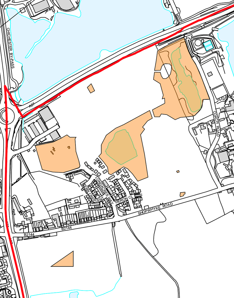
viii. Shopwyke Lakes/ New Fields
• Bikeshop/Café
• Playground
• Playground
• Playground
ix. Community Garden and Telephone Kiosk Book swap
x. St Andrew’s Church and Burial Ground
xi. Diamond Jubilee Park
xii. St Giles Church, Merston
xiii. Oving Cowshed
B. Development proposals which would affect the use of these community facilities will be determined against the provisions of Policy 38 (Local and Community facilities) and Policy 54 (Open Space, Sport and Recreation) of the CLP or successor policies.
C. Proposals to change the use of part of a community facility that is surplus to requirements to provide a village shop or community hub will be supported where they will support the overall viability and importance of the community facility concerned.
D. The comprehensive masterplan for any strategic allocation within the parish to the east of Chichester will be expected to demonstrate that the masterplan layout locates the required social infrastructure including a local shop/community hub in such a way to ensure that the existing settlement of Oving and the hamlets can access that infrastructure safely and securely.
Local Planning Policy Context
Policy OV3 accords with Local Plan Policy P17 in seeking to prevent the loss of a number of identified community facilities in the parish.
See Appendix OV3 Community Facilities
Fundamental Value of the Landscape
OV4 Green Infrastructure Network
A. The parish contains a variety of green and blue infrastructure that provides an environmental support system for the community and wildlife. The Neighbourhood Plan designates this as a Network, as shown on the Policies Map, which comprises land with known biodiversity value, including defined wildlife corridors, priority habitats, water vole networks, bat and barn owl habitats, woodlands, significant hedgerows and lines of trees, streams and other water bodies as well as amenity space.
B. Development proposals that lie within or adjoining the Network are required, where relevant, to have full regard to creating, maintaining and improving the Network, including delivering a net gain to general biodiversity value and wildlife connectivity, in the design of their layouts, landscaping schemes and public open space and play provisions.
C. Proposals that will harm or lead to the loss of land lying within the Network and that will undermine its functionality will not be supported. Development proposals that will lead to the extension of the Network will be supported, provided they are consistent with all other relevant policies of the development plan.
D. The Policies Map shows those parts of the designated Network that are known or likely to have biodiversity value either as habitat areas; as hedgerows or lines of trees; or as streams and rivers. When calculating the multiplier score, it cannot be any less than medium as the Green Infrastructure Network identifies where all the most important parts are located that will score at least medium. When calculating Biodiversity Net Gain requirements using DEFRA’s latest metric, development proposals located within or adjoining that part of the Network should anticipate achieving at least a medium distinctiveness multiplier score.
E. Biodiversity should be provided on-site within the Neighbourhood Plan area wherever possible. Off-site measures will only be considered where it can be demonstrated that, after following the mitigation hierarchy, all reasonable opportunities to achieve measurable net gains on-site have been exhausted or where greater gains can be delivered off-site through maximising local place making, including public realm improvements, and nature improvement opportunities.
Background
The Green Infrastructure Network was identified by using Natural England’s publicly accessible mapped data as a starting point (https://designatedsites.naturalengland.org.uk/GreenInfrastructure/map.aspx). This was supplemented by the manual identification of significant hedgerows, tree lining and watercourses. Playing fields, graveyards and cemeteries are identified separately as although they form part of the Network, it is for their amenity value rather than biodiversity.
Wildlife corridors have been identified as key habitats for nesting, foraging and transportation routes for wildlife. The LPA has designated wildlife corridors in Oving Parish as part of Local Plan Policy NE4.
Supporting text
Green infrastructure can be broadly defined as a network of high quality natural and semi-natural areas with other environmental features, which is designed and managed to deliver a wide range of ecosystem services and protect biodiversity in both rural and urban settings. This includes parks, public open spaces, allotments, watercourses, play areas, playing fields as well as informal open land and associated features such as trees, hedgerows, ponds, green roofs and green walls. The Policies Map shows the full extent of the Network, which allows applications to determine if their proposals should take this policy into account.
The policy requires that all development proposals that lie within the network, or that adjoin it, should consider how they may improve it, or at the very least do not undermine its integrity of connecting spaces and habitats. This may mean that development layouts are designed to contribute to the network’s effectiveness. The policy also requires a biodiversity net gain to be delivered. This is expected to be in line with national provisions which is expected to be a minimum of 10% as identified in the Environment Act 2021. Net gain will be measured using DEFRA’s latest biodiversity metric.
Clauses D and E respond to the biodiversity net gain (BNG) provisions of the Environment Act 2021 which became a statutory part of plan making and development management in February 2024 and April 2024 for small sites. The statutory BNG Metric provides the means for applicants to calculate the baseline biodiversity value of the application site in determining the net gain requirement of their proposals. The Policies Map identifies the Network that has, or are likely to have, existing biodiversity value, based on published mapped data observation and local knowledge. Green infrastructure is multi-functional but some features – for example amenity and formal recreational land – are unlikely to have biodiversity value or will be suited to improving that value by the nature of their use.
Clause D relates to those parts of the Network of biodiversity value. Given it includes all defined Priority Habitats and semi-natural habitats, native hedgerows and trees and natural water bodies, the clause anticipates that the distinctiveness multiplier score of the BNG Metric (from very low to very high) will be at least medium.
Finally, the policy sets out how the loss of biodiversity value will be addressed through a sequential approach. The new biodiversity net gain requirement of at least 10% (as set out by the Environment Act of 2021 and the Biodiversity Net Gain SPD) should be delivered either onsite or within or adjoining the Network so that the benefits of development are accrued as close as possible. However, it is accepted that the Network in the Parish may not be suited to delivering every type of required off-site gain. In such cases Clause D allows for the gain to be delivered in adjoining Parishes to Westbury or, as a final resort, on land elsewhere.
Identifying the GI network is the first step to protect its functionality and connectivity and will also contribute to maintaining access to countryside and preserving the rural character.
Local Planning Policy Context
Policy OV4 accords with Local Plan Policies NE4, NE5, NE8, P14 and P15 in requiring proposals, where relevant, to enhance and extend the green infrastructure network, as identified on the Policies Map. The wildlife corridor element of OV4 matches the wildlife corridors in Policy NE4 of the Local Plan.
OV5 Local Green Spaces
A. The Neighbourhood Plan designates the following Local Green Spaces, as shown on the Policies Map:
• Diamond Jubilee Park in Oving Village
• Cemetery off Church Lane, Oving
• Narrow pasture land either side of Marsh Lane, Merston
• Land to east of (grade 1 listed) Church of St Giles, Merston
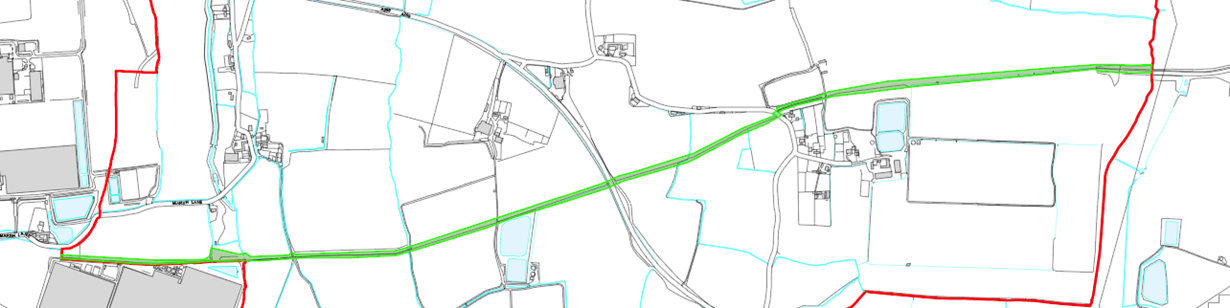
• Route of former Chichester/ Arundel canal in Merston and Colworth
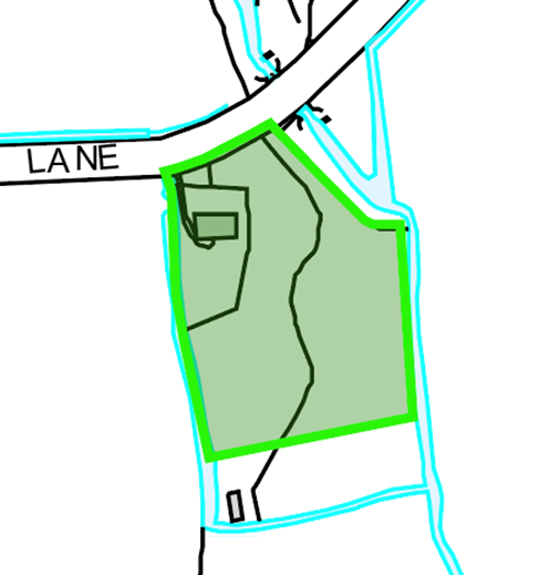
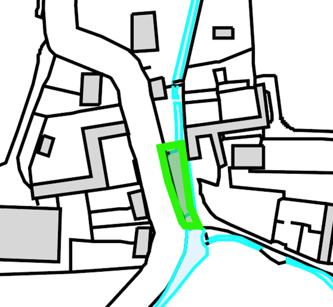
• Duck pond, bridge and grassy bank in Merston
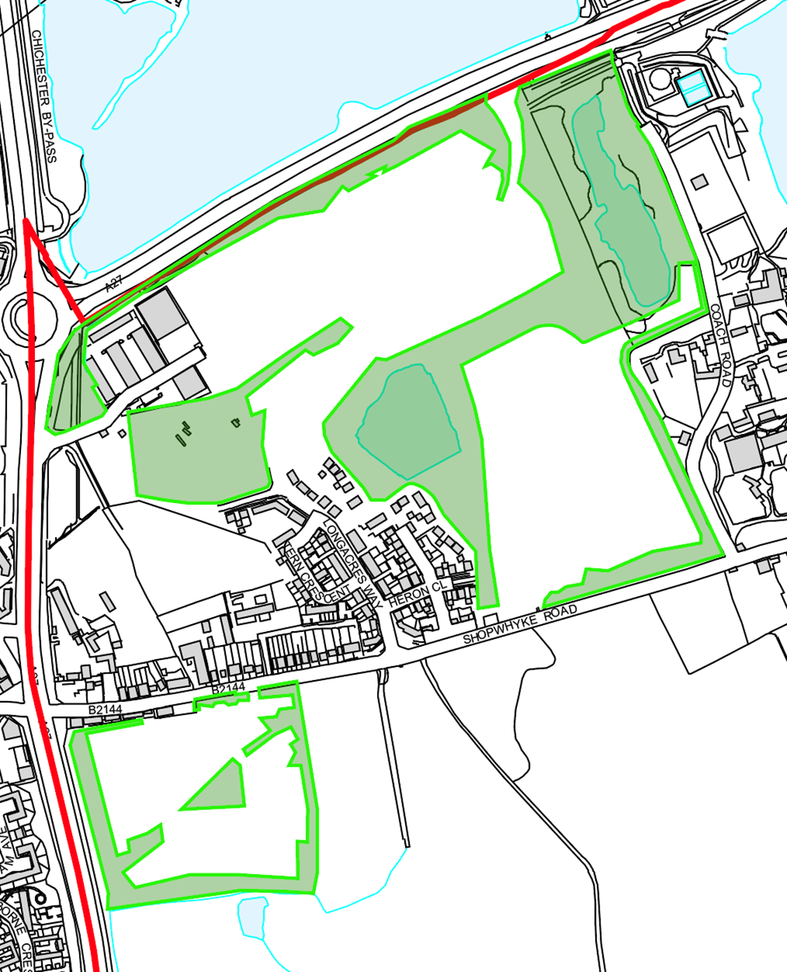
• Green Spaces within the Shopwyke Lakes and Redrow estates
• The old road route from Church Lane to Woodfield house
B. Proposals for inappropriate development in a Local Green Space will only be supported in very special circumstances.
Introduction/ purpose
The NPPF states that ‘‘the designation of land as Local Green Space through local and neighbourhood plans allows communities to identify and protect green areas of particular importance to them.’’ In addition: The Local Green Space designation should only be used where the green space is:
(a) in reasonably close proximity to the community it serves;
(b) demonstrably special to a local community and holds a particular local significance, for example because of its beauty, historic significance, recreational value (including as a playing field), tranquillity or richness of its wildlife; and is
(c) local in character and not an extensive tract of land.
A designation has the policy effect of the equivalence of the Green Belt in terms of the definition of ‘inappropriate development’, consistent with paragraphs 105-107 and 152 of the NPPF and of the ‘very special circumstances’ tests in the NPPF when determining planning applications located within a designated Local Green Space.
Background
Oving Parish Council engaged consultants terra firma in June 2021 to undertake a parish study to establish if there were areas that could be proposed for designation that met the NPPF criteria. The study concluded that there were eight such areas and these are accordingly included in the Oving Neighbourhood Plan. See Appendix OV5 and LGS Analysis Sheets published in the evidence base.
Local Planning Policy Context
Policy OV5 accords with Local Plan Policies P14 and P15. OV5 goes a step further by formally designating the identified spaces as Local Green Spaces.
References
The Terra Firma Consultancy Limited reports on Local Green Space and Oving Landscape Capacity (December 2021)
Aesthetic Value of the Landscape
OV6 Valued Landscapes
A. The Neighbourhood Plan defines several Landscape Gaps (comprised of 15 smaller parcels), as shown on the Policies Map, for the spatial purpose of preventing the visual coalescence of settlements within and adjoining the Parish:
i. Shopwyke and Oving
ii. Tangmere and Shopwyke
iii. Tangmere and Oving
v. Runcton and Merston
B. Development proposals that lie within a defined Landscape Gap must be located and designed in such a way as to prevent the visual coalescence of the settlements.
C. The Neighbourhood Plan identifies Important Views, as shown on the Policies Map. Development proposals that are located within or immediately adjoining an Important View will only be supported if it can be demonstrated that the key features of the view can continue to be enjoyed including views of Chichester Cathedral, views to and from South Downs National Park, areas of landscape and the juxtaposition of the village edge and surrounding countryside.
Supporting text
A landscape gap assessment report was commissioned from an independent landscape consultant. The most recent version of this report analysed 21 individual assessment parcels to consider their suitability as defined Landscape Gaps. The conclusion of this comprehensive report recommends that 15 of the 21 assessment parcels are designated as Landscape Gaps. The Neighbourhood Plan Policies Map shows these in a group, but the boundaries of the individual parcels can be found on p.17 of the landscape gap assessment report and as copied below.

The policy, and Policies Map, identifies a series of views in the Parish that are considered an important element of preserving the character of the village and the surrounding landscape. Development which would obstruct such a view, or which would lead to a detrimental impact on the view should not be permitted. Each of the important views identified is shown on the Policies Map, whilst a photograph and a description of each view is shown in Appendix OV6.
Local Planning Policy Context
Policy OV6 accords with Local Plan Policy NE2 in seeking to prevent adverse impact on Important Views identified within the parish. OV6 also accords with Local Plan Policy NE3 which offers neighbourhood plans scope to identify the boundaries of Landscape Gaps.
Reference: Hankinson Duckett Associates. Oving West Sussex Landscape Gap Assessment: Refined Area for Oving Parish Council. October 2025, OV6 Important Views Report
OV7 Dark Skies
A. All development proposals should be designed to minimise the occurrence of light pollution. The Parish Council will expect such schemes to employ energy efficient forms of lighting that also reduce light scatter and comply with the current guidelines established for rural areas by the Institute of Lighting Professionals (ILP).
B. Proposals for all development will be expected to demonstrate how it is intended to prevent light pollution. Information on these measures must be submitted with applications, and where a development would potentially have an impact on light levels in the area, an appropriate lighting scheme will be secured by planning condition.
Supporting text
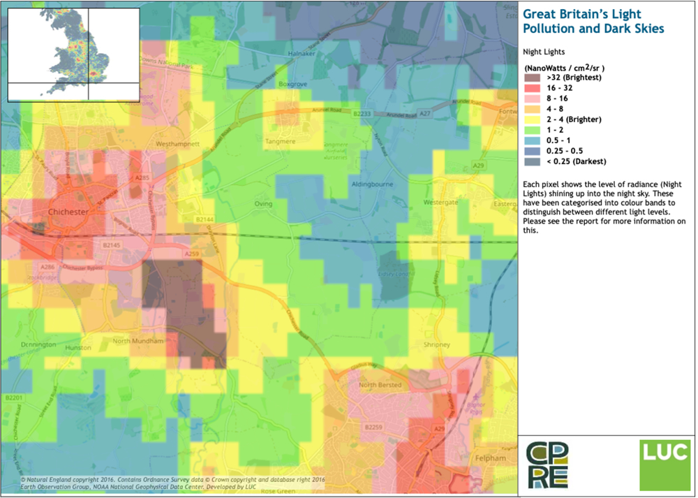
Half of Oving village and the hamlets have never had street lighting installed. As a result, the undeveloped parts of the parish enjoy relatively low light levels. These enable residents to appreciate the night sky and the darkened landscape and to control, to a large extent, the amount of light that illuminates their properties at night. Low light levels are an important benefit to wildlife because there is minimal disturbance to the regular patterns of nocturnal insects, birds and mammals.
The darkest skies are those farthest from Chichester city, the glasshouses areas in the Horticultural Development Area and the A27 and A259 corridors. The rest of the parish is relatively dark (1-4 nano watts/cm2/sr).
It is important that lighting in new developments is strictly controlled especially when it would affect the quality of listed buildings or Conservation Area, the wildlife corridors or the setting of the South Downs National Park, an International Dark Sky Reserve.
There are three common sources of light pollution. The first is glow which emanates from settlements. Sky glow from Chichester and Tangmere is visible in the parish. The second is glare, which is caused by bright light viewed against darkness. The third is light intrusion which is light spilling beyond the property being lit. This is most pronounced from glasshouses where there is not light cover at night.
The use of energy efficient lighting, cowls and careful directional lighting can achieve considerable benefits. Particular care is required in the design of lighting for some types of development, for example community buildings and sports pitches, which otherwise can cause considerable pollution far beyond their immediate boundaries.
Local Planning Policy Context
Policy OV7 accords with Local Plan Policies NE21 and NE22 in requiring development proposals to consider the impact of their lighting schemes on light pollution.
Getting About
OV8 Active and Sustainable Travel Network
A. The Neighbourhood Plan identifies an Active and Sustainable Travel Network, as shown on the Policies Map, for the purpose of supporting active and sustainable travel in the Parish.
B. Development proposals on land that lies within or adjacent to the Network should retain, and where practicable, enhance the functionality of the Network by virtue of their layout, means of access and landscape treatment. Proposals that will harm the functioning or connectivity of the Network will not be supported.
C. Bus shelters need to be designed to comply with their setting. Shelters in a conservation area will differ from those in or close to a modern housing estate.
D. Development proposals that provide developer contributions towards the delivery of the proposed cycling infrastructure and footpaths shown on the Policies Map will be especially encouraged.
E. Development proposals to provide new bridleways to connect with other parts of the Parish through S106 contributions or whatever community contributions may follow, will be supported.
Introduction/purpose
Oving parish consists of the village of Oving and the hamlets of Drayton, Merston, Shopwyke, and Colworth. There are also the recent large developments at Shopwyke Lakes to the north and south of Shopwyke Road.
Communication among these population centres and with Chichester consists of mostly and often narrow unclassified roads. There are no cycle or pedestrian paths, paved or otherwise, to speak of, and public transport except for the 700 that runs along the A259 and the 500 that runs through Shopwyke is minimal.
Improved connectivity within the parish and with nearby settlements including Chichester, Tangmere, Barnham and Bognor Regis is the top priority of the neighbourhood plan.
Background
Critical connections
Chichester city centre. A27 to the North and West is a significant barrier
Chichester bus station
Railway stations at Chichester and Barnham
Places of employment
Leisure, eg Everyone Active at Westgate, Goodwood etc
St Richard’s hospital
Nearest major food retail: Portfield (Sainsbury, M&S, Lidl, Aldi and Iceland); Tangmere (Coop)
Other cycle paths, eg South coast cycle path and Centurion / Salterns Way.
Schools: The March C of E Primary School at Westhampnett, Boxgrove C of E Primary School, Portfield Primary School and Tangmere Primary Academy
If a cycle route into Chichester can be created, access to the city’s secondary and primary schools can be safe.
Medical and dental surgeries in Tangmere
Post Office at Tangmere.
Current status of facilities for people movement
Over 98% of journeys are currently undertaken by car.
The only usable cycle path/ footpaths connect Oving village with Tangmere and Shopwyke with Chichester and Westhampnett.
There are a number of official footpaths for walking, but none provide a connection to core activity areas within or outside the parish. Most are impassable during winter or wet weather. There is a route for walking between Oving village and Shopwyke but it doesn’t connect with route to Chichester.
There is an infrequent bus service through Drayton, Oving Village and Woodhorn with as yet mostly uncovered stops. There is a frequent 700 service from the south west of the parish to Chichester along the A259.
There are two cycle paths (National cycle route 2) via the A259 and one via Maudlin that can be used to access Chichester but with many unsafe interruptions and significant extra distance. WSCC cycle routes include minor single track roads used as rat runs and unsafe for cycling.
Supporting text
The overall policy is to provide easy, convenient and safe connectivity between key areas. This is to be read in conjunction with the map. This will be achieved by:
1. A network of dual purpose foot/cycle paths of all weather capability.
For these to be used they have to connect safely with the Critical Connections. This will entail working with CDC and other parish councils to ensure joined up connectivity.
This will also involve working with landowners and may call for compulsory purchase if needed.
The parish will work with WSCC and CDC as they prepare their update to the 2016 to 2026 Sussex Walking and Cycling strategy.
2. Bus stops and routes will be sited at strategic locations including junctions of footpaths where feasible.
Bus shelters will be designed to be in compliance with their environment eg conservation area, protected setting, major new urban type development. Stops will be covered.
The parish would work with bus companies, other transport providers and other parishes, eg Tangmere, to provide a more frequent service. There may be a case for commissioning private minibus operators in conjunction with other parishes.
3. The parish will support the installation of electric charging points and appropriate car parking for electric cars, as well as basic bicycle charging/maintenance facilities.
The policy will require development proposals to ensure that schemes do not harm the functioning or connectivity of the network but sustain and where possible, enhance it.
The policy will also seek contributions for public realm improvements and traffic mitigation measures.
The Policies Map will enable applicants to determine if their proposals should take this policy into account. Where proposals include provision for landscaping, new means of access or new layouts, there may be an opportunity to relate the land better to the network and/or improve the attractiveness of rural routes. At the very least, the policy requires that proposals that will undermine the existing value of the network will be refused permission.
Local Planning Policy Context
Policy OV8 accords with Local Plan Policies T1, T2, T3 and P4 in encouraging new development proposals to enhance the functionality of the Active and Sustainable Travel Network and not supporting proposals which harm its functionality.
References
https://www.westsussex.gov.uk/about-the-council/policies-and-reports/roads-and-travel-policy-and-reports/west-sussex-walking-and-cycling-strategy-2016-2026/
Design and Heritage
OV9 High Quality Design
A. All development proposals should adhere to the provisions of the Oving Design Code as relevant to their nature, scale and location.
B. All major development schemes with a residential component should submit a ‘Building for a Healthy Life’ design assessment to demonstrate how the design proposals will achieve those objectives.
Introduction/ purpose
There are distinctive features of Oving that shapes it character. These features
are set out in the Oving Design Code. The Code is an integral part of the policy but is extensive and the document is therefore published in the evidence base. It therefore carries the full weight of the development plan in decision making and is not subordinate or supplementary guidance carrying lesser weight.
Supporting Text
The policy requires that applicants should adhere to the design principles and guidance the Code contains as relevant to the nature, scale and location of their proposals. The policy does not advocate pastiche or historic solutions; however, it is important that any new development demonstrates a connection with local character and place making. Where a proposal does not follow the requirements of the Code then the applicant will be obliged to justify why an exception should be made.
The Oving Design Code is published in the evidence base due to the length of the document.
Local Planning Policy Context
Policy OV9 accords with Local Plan Policies P1, P2 and P8 in respect of supporting high quality design that also recognises the character and heritage of the surrounding area.
OV10 Oving Conservation Area
A. Development proposals should preserve and enhance the special architectural and historic significance of the designated Oving Conservation Area and its setting.
B. All proposals must have full regard to the significant features identified as positive characteristics of the Conservation Area and its immediate setting as defined in the Oving Conservation Area Appraisal and the Oving Design Code (Chapter 2 and figure 13)
Background
A policy for the Chichester Conservation Area was determined by Chichester District Council in 2012. Little has changed since then apart from two small estates of affordable housing in Gribble Lane.
Supporting text
This policy directs applicants bringing forward proposals within the Oving Conservation Area or its setting to the design principles and guidance contained in the Oving Conservation Area Character Appraisal and Management Proposals (CACAMP)
Local Planning Policy Context
Policy OV10 accords with Local Plan Policies P9 and P11 in seeking new development to respond positively to the special architectural and historic significance of the designated Oving Conservation Area and its setting.
OV11 Non-Designated Heritage Assets
A. The Neighbourhood Plan identifies 7 Non-Designated Heritage Assets, as shown on the Policies Map and in Appendix OV11.
B. In weighing up proposals that affect a Non-Designated Heritage Assets, a balanced judgment will be required having regard to the scale of any harm or loss and the significance of the heritage asset as identified in the schedule. Proposals that will result in harm to, or unnecessary loss of, a Non-Designated Heritage Assets, will be resisted, unless it can be demonstrated that there is a public benefit that outweighs the harm or loss.
Local Planning Policy Context
Policy OV11 accords with Local Plan Policies P2, P9 and P12 in designating a number of identified Non-Designated Heritage Assets so that the impact of development proposals on Non-Designated Heritage Assets can be considered in their determination.
Supporting text
In identifying candidates for this protection reference was made to Historic England’s criteria for assessing value of assets in terms of architectural, archaeological and historic interest. Analysis sheets of the Non-Designated Heritage Assets are published in the evidence base.
See Appendix OV11 Heritage Assets
OV12 Tall Buildings and the skyline in Oving
A. Tall building proposals must ensure they do not undermine the landscape character or heritage of the Parish. Any proposal for a building or structure over 2.5 storeys that breaks the existing skyline and/or is significantly taller than the surrounding built form (>1 storey taller than the surrounding buildings) will be considered against the following criteria:
(i). location, setting and context – applicants should demonstrate through visual assessment or appraisal with supporting accurate visual representations, how the proposals fit within the existing low lying landscape character of the Parish;
(ii). Impact on historic environment – applicants should demonstrate and quantify the potential harm of proposals to the significance of heritage assets or other sensitive receptors, assessed on a site-by-site basis but including impact on key landmarks, settings and viewpoints, as well as from the rural lanes and other public spaces in the village and hamlets;
(iii) architectural quality – applicants should demonstrate through accurate visual representations how the proposals will deliver a high quality addition to the Oving skyline and clearly demonstrate there is no adverse impact. Final ground levels will be included within any application relating to the nearest existing properties in order to be able to relate proposals accurately.
Supporting text
The parish is generally free from taller and bulky buildings over three storeys with the notable exception of the Chichester Food Park which while within an area of medium to high landscape capacity, sits in stark contrast to the low lying flat landscape to the north of the A259 which provides the setting to Oving and the hamlets. While there has been little move to build taller buildings, any proposals for taller buildings must be carefully considered.
There are a large number of designated heritage assets within the Parish and a number of important views. Accordingly, the potential impact that a proposal for a tall building have on the significance of those assets will be a critical factor in the acceptability of a proposal. For this reason, it is very unlikely that there would be many instances or scope for introducing new, tall buildings in the parish.
Local Planning Policy Context
Policy OV12 accords with Local Plan Policies P1, P2, P9, P10 and P12 in requiring proposals to consider how their height is appropriate to the surrounding area, including how it impacts on heritage assets.
OV13 Affordable Housing and community-led housing development
A. Proposals to deliver affordable homes including First Homes, to meet the needs of existing and future residents will generally be supported.
B. The size, mix and tenure of affordable units will have regard to the most recent HEDNA (Housing and Economic Needs assessment) or any such replacement document and the District Council’s Housing Register. At the time of the preparation of the plan the greatest need is for one bedroom homes but opportunities should also be found a range of sizes with an emphasis for younger and older persons looking for two bedroom homes including bungalows.
C. On sites of over 10 dwellings the provision of affordable homes will be 30% of greenfield sites and 20% of previously developed sites. Proposals for rural exception sites and community-led exception sites will be encouraged and should give preferences to residents with a parish connection
Supporting text
The policy establishes the goal of delivering affordable homes to meet local needs. In May 2019, Oving Parish Council commissioned Chichester District Council’s Housing Delivery Team to assess the housing needs of the Parish. The Survey Report published in January 2020 identified a need for 22 affordable homes to benefit the Parish, both for younger households and for downsizers and of a housing type and mix as expressed in clause C (i). The Housing Needs Survey provides the evidence to justify a minor departure from the type and mix expressed in the CDC Housing and Economic Needs Assessment.
The whole of Oving Parish is defined as a ‘designated rural area’ under Section 157(1) of the Housing Act 1985. In designated rural areas local planning authorities may choose to set lower affordable housing thresholds and seek affordable housing contributions from developments above that threshold in line with Planning Practice Guidance Paragraph: 023 Reference ID: 23b-023-20190901. The parish is therefore exempt from the usual 10 dwelling threshold for securing affordable housing contributions.
The Parish Council will require affordable housing to be provided on-site, unless there are exceptional circumstances that mean off-site provision, or a financial contribution of broadly equivalent value can be robustly justified. This approach is intended to ensure the objective of meeting local housing need for those with a proven parish connection to Oving is not undermined.
Local Planning Policy Context
Policy OV13 accords with Local Plan Policy H4 in seeking to deliver affordable housing in line with the local needs identified in the Housing Needs Survey. The policy also reflects Oving’s status as a ‘designated rural area’.
References
AECOM Oving Design Guidelines and Codes Final Report October 2025 (ODGC)
Oving Conservation Area Character Appraisal and Management Proposals (CACAMP) September 2006
Oving Village Character and Heritage Analysis Figure 13 (Chapter 2 ODGC)
Oving Housing Need Survey Report 2020
National Model Design Code: https://www.gov.uk/government/consultations/national-planning-policy-framework-and-national-model-design-code-consultation-proposals/national-model-design-code-accessible-version
Health and Wellbeing: West Sussex Joint Strategic Needs Assessment 2019
https://www.chichester.gov.uk/article/30928/Supporting-evidence—Local-Plan-review
‘The Setting of Heritage Assets: Historic Environment Good Practice Advice in Planning Note 3 (Second Edition)’ December 201?
7. Appendices to the policies and community engagement
Appendix OV2 New Local Services
Appendix OV3 Community Facilities
Appendix OV5 Local Green Spaces List
Appendix OV8 Important Views
Appendix OV11 Heritage Assets List
Appendix OV2 New Local Services
Village Shop and Community Hub
The following is a report the Steering Group commissioned one of its members write more than two years before the Oving Cowshed was set up and the Shopwyke Lakes development had been built out to include a Community hub and Bike shop.
SQ October 28, 2024
Background
Many respondents to consultation about the Neighbourhood Plan have suggested a desire for a local shop. I was asked to investigate the award winning Fittleworth Stores as I had contacts there and make some recommendations as a result.
I met with Mick Foote, chair of the shop management committee, on June 9, 2021. In advance he shared with me their original business plan and other reports including one from the Plunkett Foundation (“a national charity that supports rural communities across the UK to tackle the issues they face through community business”). https://plunkett.co.uk/
Fittleworth
Prior to the meeting I did some research into Fittleworth and discovered that it had a good deal in common with Oving parish before the current and proposed developments at Shopwyke. Population similar; nice country village; parish includes other hamlets such as Bedham and Stopham. Nearby supermarkets – Tesco in Pulborough about seven minutes drive, with Sainsburys a minute further on and a large Co-op the same distance in Petworth. There is also Charlie’s Farm Shop on the A29 at Bury. There are, of course, differences: there is a primary school in Fittleworth adjacent to the village hall and where the shop is sited. From Oving you can cycle across the airfield to the Tangmere Co-op in under ten minutes or even walk there in half an hour.
Staffing
Discussing their shop with Mick Foote a number of requirements became apparent:
Firstly, two or three volunteers who are committed, available, and financially aware, to act as project sponsors to get the place created and established. This will include securing a suitable site, getting grants and other finance, and establishing a management structure. They must be willing to stay on after opening to see the place running well.
In addition, a large number of volunteers prepared to commit to regularly working unpaid in the shop. Training is provided.
Site
Must be visible on well used road with good parking, within walking distance of a significant proportion of the parish/village. At Fittleworth the café with windows looking out over kids playground is a great attraction. It also attracts passing trade, walkers, cyclists, delivery drivers, as well as locals, parents/grandparents picking up from school etc. Helps greatly in making the place a community hub.
Product range
Post Office. Brings people in – very popular. Earns modest fee but is run by people serving behind counter and there anyway so little extra cost. Post Office means shop/café takings can be banked immediately on site, no need to go into town to find a bank. Post Office can provide alarms and safes. Newspaper sales attract older customers.
Basics (e.g. milk) have to be sold at reasonable (i.e. low margin) prices so as to not give the impression the place is expensive. They sell all the basics plus products from local producers both food and craft. Bread tends to be from local bakers and much cheese is sourced locally too.
Finance
The building needs to be “free” (i.e. no rent or mortgage). At Fittleworth the land was provided by the Parish Council. The sponsors raised almost £300,000 to build and equip the building and provide working capital. They did so by grants, donations and sales of shares in the company (which have no resale value but can attract tax relief under SEEIS).
The store has been granted relief of business rates by the District Council as a sole rural shop serving the area. This could be more difficult to achieve in Oving village and highly unlikely in the new Shopwyke developments.
I was told that Fittleworth Stores in the summer of 2021 was trading very successfully, well ahead of the most optimistic business plan forecast. The management committee was looking to expand. During lockdowns they arranged home deliveries and placed additional stock in the café area, moving tables and chairs outside under a marquee.
They are now (January 2022) on site with an extension costing some £90,000 to bring the café back into the building.
Conclusions and recommendations
Fittleworth is a good example of a community facility that is very popular. However, the parish of Oving is changing so dramatically with the developments at Shopwyke and potentially Drayton that it is difficult to make any predictions.
It is quite possible that a convenience store on a commercial basis will eventually be opened at either Shopwyke Lakes or AL3 and this should be supported.
It is suggested that the garden centre at Shopwyke Nurseries should be supported in developments to enable it to keep pace with the garden centre market.
For a shop to be developed in Oving village the key requirements are:
• Enthusiastic and determined project sponsors to push the project along, raise money etc
• Suitable site available at no cost. Ability to raise money to cover build cost.
• CDC to agree to grant relief from business rates.
• Site in convenient location for majority of village residents but also on main road and with good access and parking and able to act as a community hub ideally with a café of some sort
• Group of volunteers to commit to work in the shop unpaid
• Agreement to open Post Office, if not then arrangement with courier firm/ Amazon drop box etc.
• Differentiate the offer from Co-op. One Stop etc. Local produce, crafts etc as well as basics.
• If these conditions can be met, then the project should be supported.
Clive Sayer
Member of Oving Neighbourhood Plan Steering Group
Appendix OV3 Community Facilities
Oving Jubilee Hall
A modern (built 2002) multipurpose village hall with wheelchair access and facilities used by many community groups and organisations. The main hall can accommodate up to 150 seated guests (e.g. for weddings and community social events) and has a large stage with changing facilities. A separate meeting room is equipped with built-in video conferencing support. The hall has a modern, well equipped kitchen with facilities for food preparation, cooking and refrigeration, plus servery.
Oving Jubilee Hall serves as the essential community hub for Oving village and the wider parish.
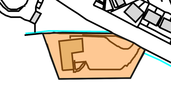
Gribble Inn pub (closed after a fire)
The Gribble Inn has been thriving in Oving village since 1980 when the 16th century thatched cottage, previously owned by Mrs Rose Gribble, was converted to a pub. There is a separate ‘brewery tap’ barn that is available for private hire for up to fifty people. The pub also has a renowned micro-brewery.
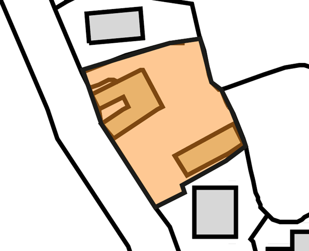
Flip out centre
Flip Out Chichester is the biggest adventure trampoline centre in West Sussex combined with various family attractions such as soft play areas and assault courses. Flip Out is part of a nationwide franchise.
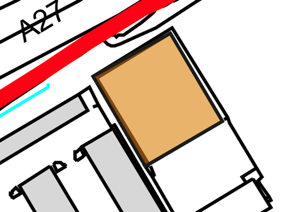
Westbourne House School
A number of external groups offer swimming lessons in the pool, for adults and for children. Westbourne House also hosts activity summer holiday camps.
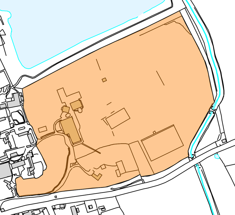
High quality tourist accommodation
Madame Green Farm in Oving village hosts unique self-catering facilities ranging from the 18th century farmhouse to luxury ‘beach’ huts. Flintstone Cottages, around one mile east of Oving village, offers self-catering accommodation in out-buildings of the Victorian flint knapped Sussex farmhouse.
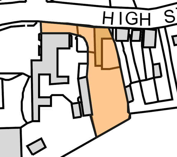
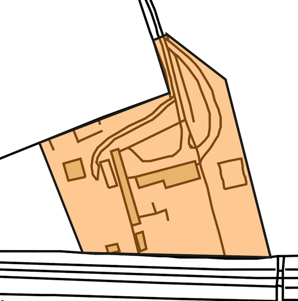
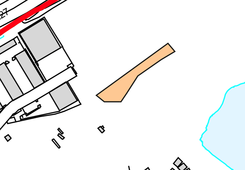
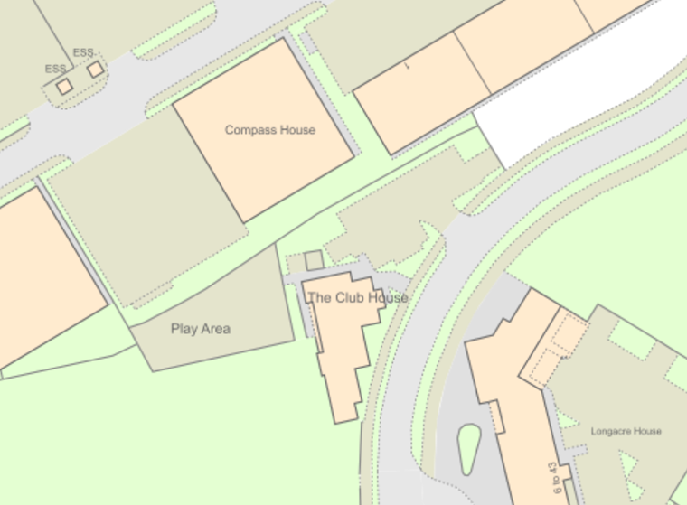
Shopwyke Lakes Club House (also known as the Pavilion)
Teddy Wilf’s Nursery offers opportunities for the local community, offering nursery facilities Monday-Friday. The Club House will be available for weekend hire, for parties, community events, and private functions. There are changing rooms to enable use as a sport pavilion.
Shopwyke Retail facilities
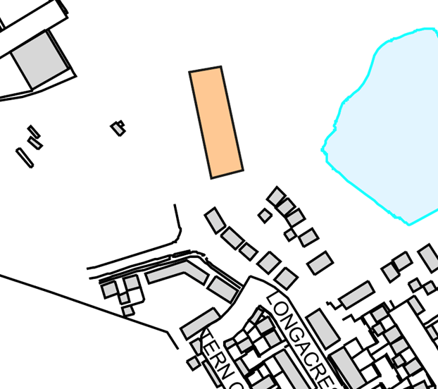
Shopwyke Lakes hosts a small pharmacy and a small supermarket at Longacres House. This also includes Chichester Bike Project which is primarily used as a bike space with store, workshops and cafe, with bookable meetings rooms.
Shopwyke Lakes/ New Fields
• Bikeshop/Café
• Playground
• Playground
• Playground
Community Garden and Telephone Kiosk Book swap.
Oving Community Garden is a relatively new project involving all ages in the community from the youngest to the eldest. The garden has raised beds, a community garden shed, an orchard, a seating area with fire pit or BBQ, a compost area and water storage.
Volunteers have turned the disused telephone box in Oving into a community book swap facility
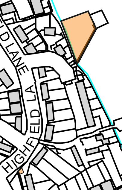
St Andrew’s Church and Burial Ground
The very attractive galletted flint 13th Century Parish Church of St. Andrew’s sits at the very heart of the village. Eucharist Services are held every Sunday. The burial ground is the peaceful resting place for many well loved and respectfully remembered parish residents.
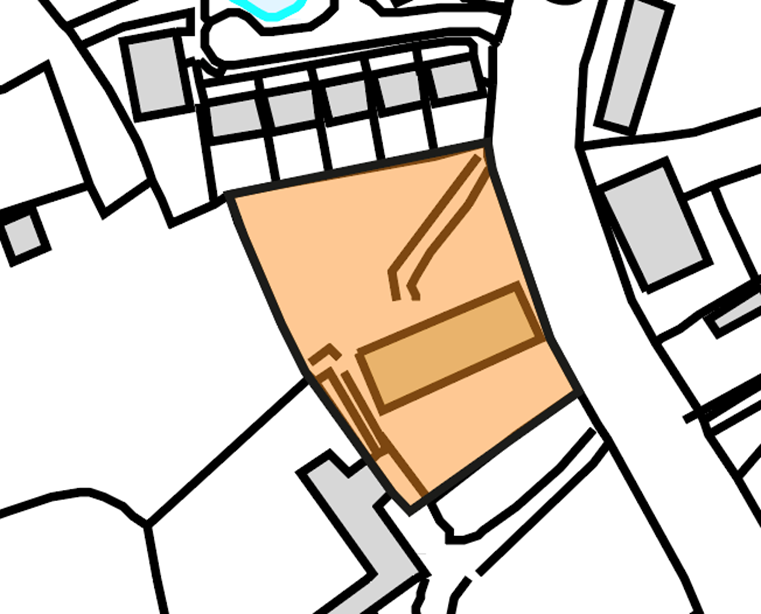
Diamond Jubilee Park
Oving village recreation ground is an important green space facility for all parish residents and is available for sporting use and community outdoor recreation. It is the site of Oving Community Garden, a BMX cycle track and a children’s play area.
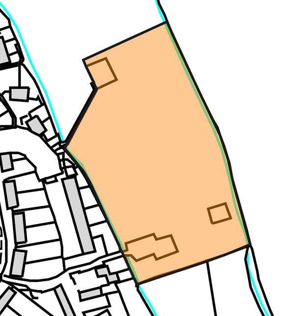
St Giles Church, Merston
The small and charming St Giles church is generally identified as thirteenth century. The church was closed in 2010 due to safety concerns but following extensive renovation was reopened in 2017 and is now open to visitors at limited times in the summer. It is owned by the Churches Conservation Trust and remains a consecrated Grade 1 listed building.
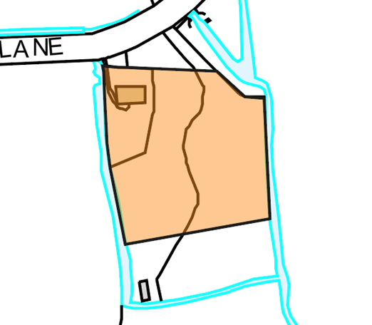
Oving Cowshed
Dispenses on payment: fresh milk and milk based drinks, cheese, crackers and confectionery. Located at Oving Jubilee Hall
Appendix OV5 Local Green Spaces List
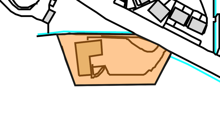
• Diamond Jubilee Park in Oving Village
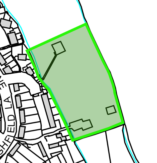
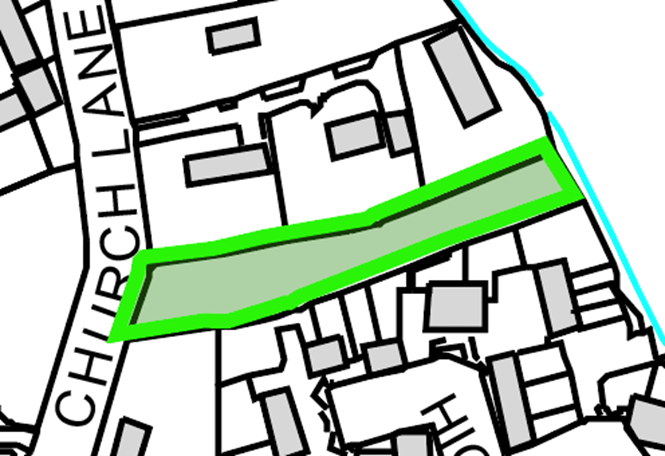
• Cemetery off Church Lane, Oving.
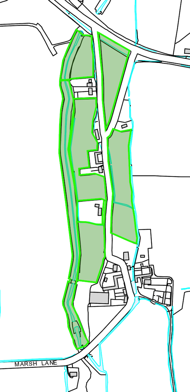
• Land further south in Merston to east of grade 1 listed Church of St Giles.
• Route of former canal in Merston and Colworth
• Duck pond, bridge and grassy bank in Merston where people stop and enjoy the setting.
• Areas of green space in subject Shopwyke Lakes development and New Fields.
• Old Oving Road, subject to the freedom of access for any traffic associated with the business of the owners be permitted on a 24/7 basis.
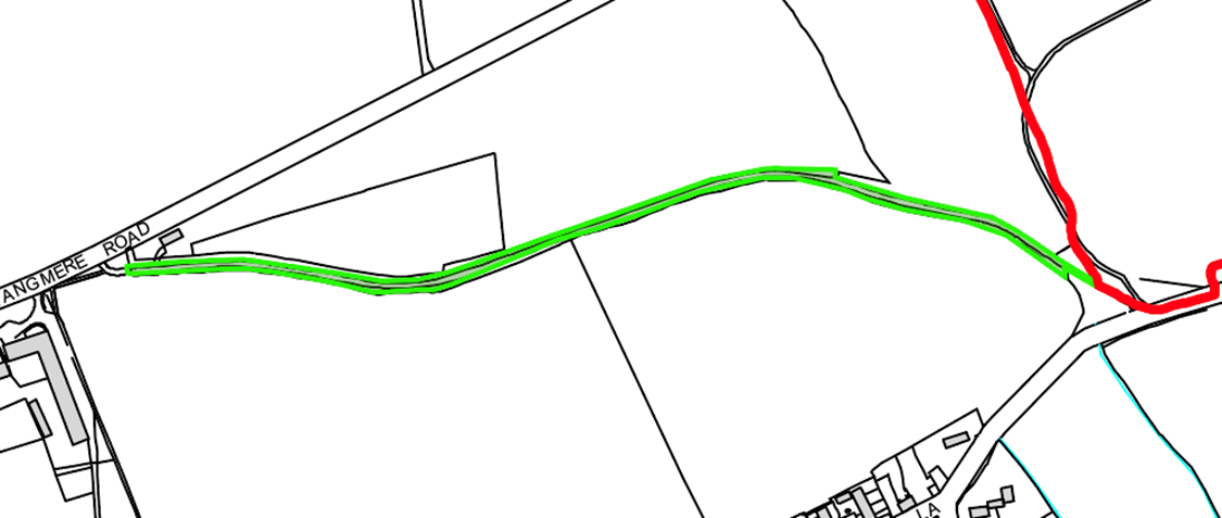
Appendix OV6 Important Views
01 Shopwyke Road
An inviting leafy perspective offering the opportunity to continue along past some exceptional examples of early eighteenth century domestic architecture.
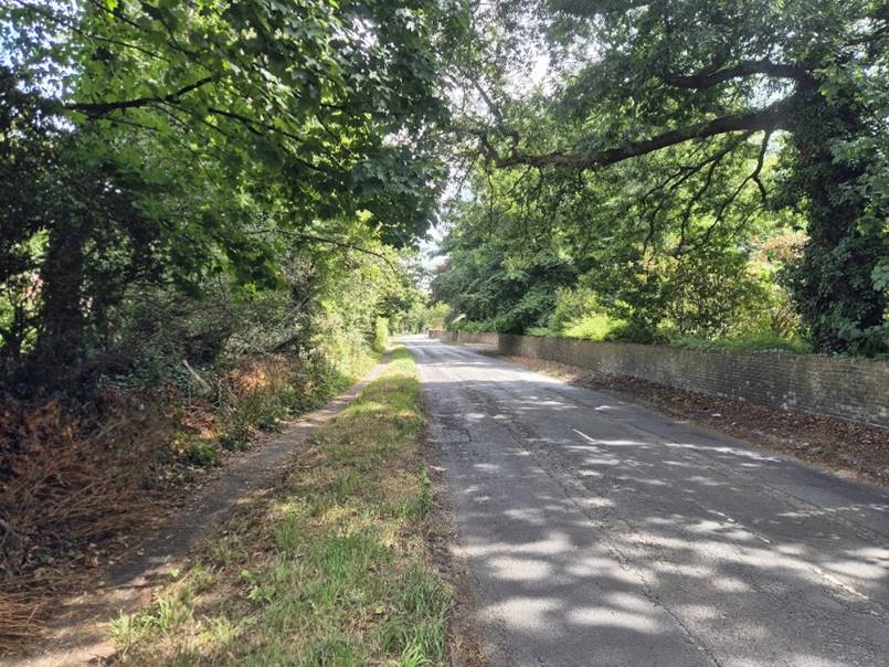
02 SE Footpath
A preserved and popular Public Right of Way (PROW) across typical local farmland towards the village of Oving.
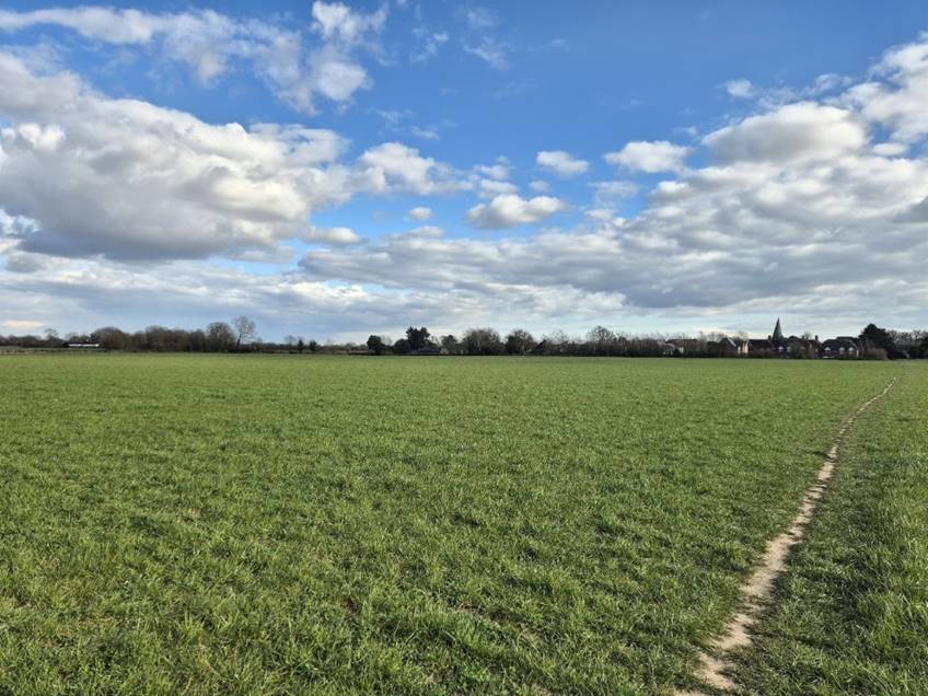
02 SW Footpath
The second or twin PROW towards Oving village with the church spire acting as a historic focal point in the landscape.
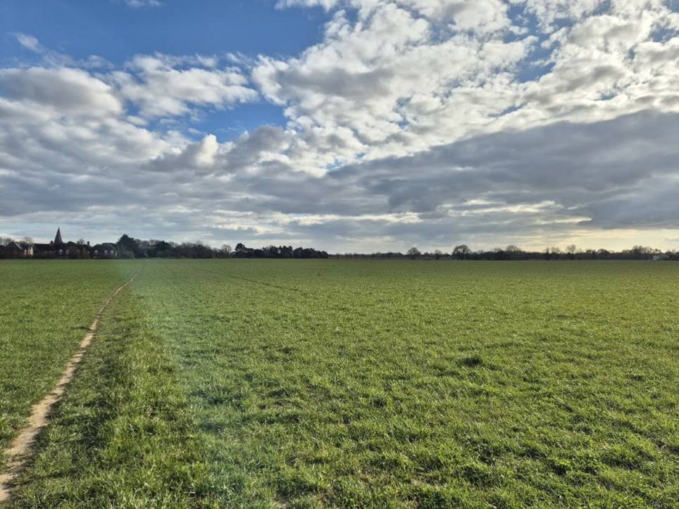
03 Tangmere Cycle Path
Characteristic uninterrupted long views over the local landscape towards the South Downs, a route used for leisure and work.
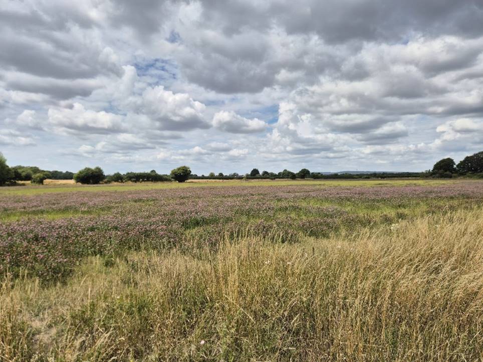
04 N Twitten
Typical expansive view of the flat farmland bounded by mixed hedging and trees, crossed by footpaths that are used and valued by residents and visitors.
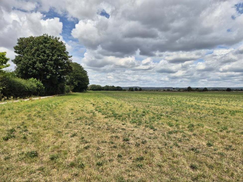
04 NE Twitten
Broad view of the open farmland characteristic of the parish, bounded by mixed hedging and trees with the South Downs National Park as a background.
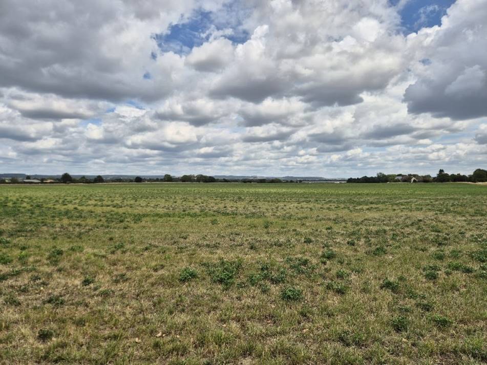
05 Marlpit Lane
A significantly named surviving cultural feature of the area, a partially sunken single track lane (holloway) with preserved verges and drainage ditch.
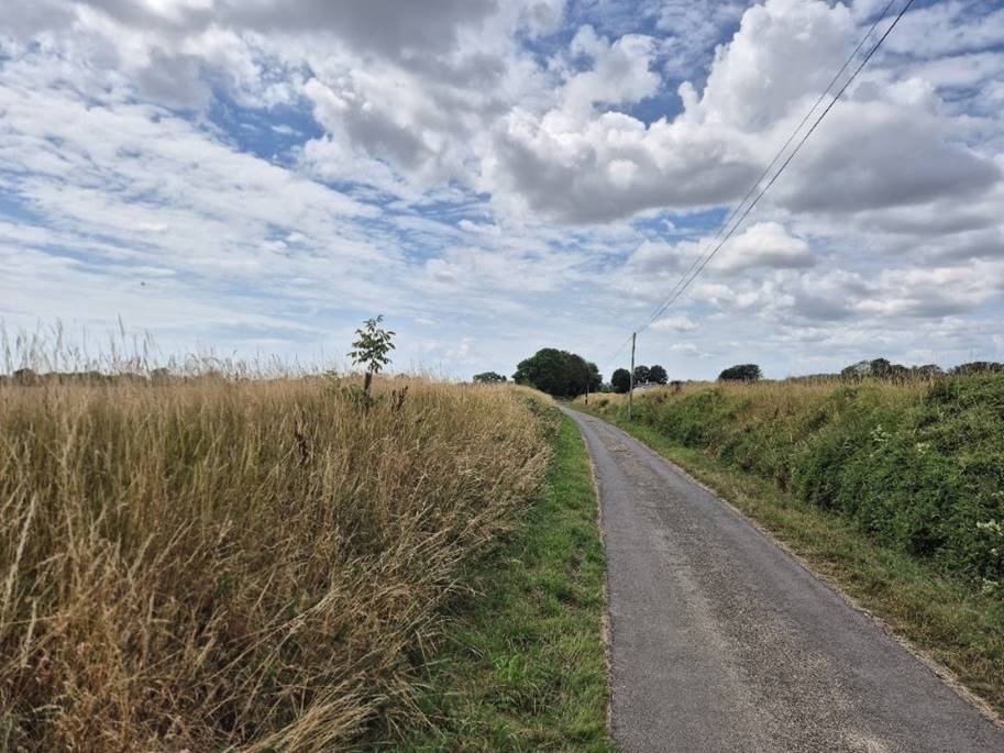
06 Oving Village
A broad view of hedges, trees, a crop and wildlife habitats serving to illustrate the historic character of Oving village as being surrounded by open farmland on all sides.
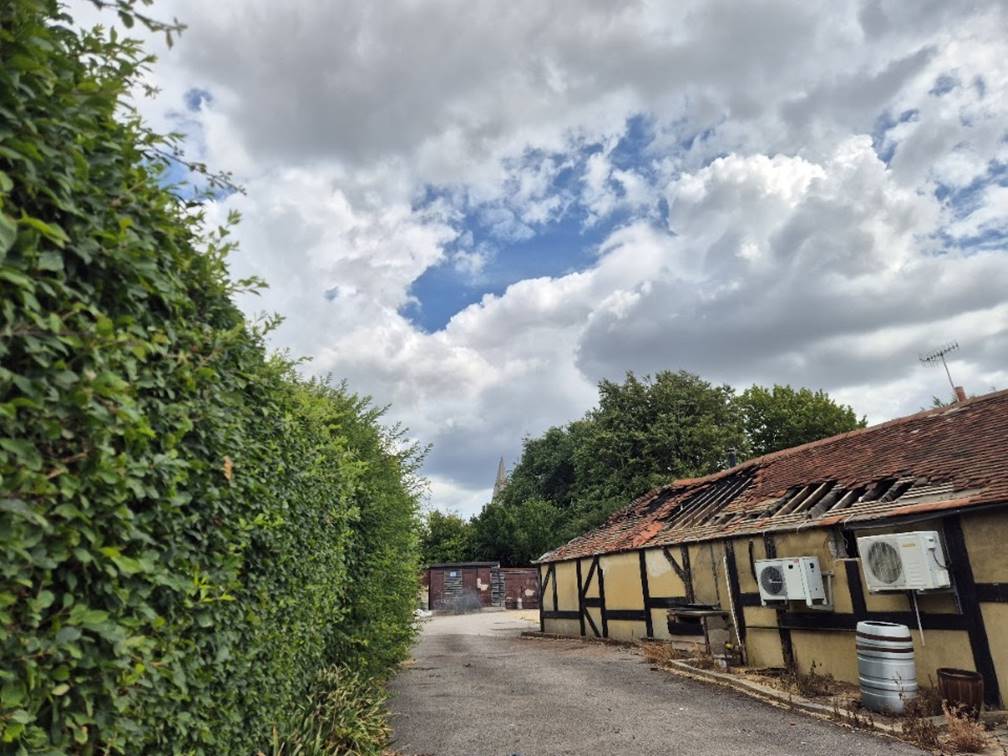
07 Gribble to Church
The cultural heritage of Oving is associated with the thirteenth century St Andrew’s Church here seen beyond the sixteenth century Gribble Inn (closed after a fire).
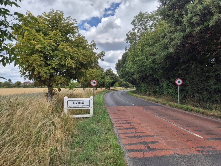
08 Oving Road
What becomes a narrow winding road passing through Oving village is here bordered by an avenue of trees and farmland.
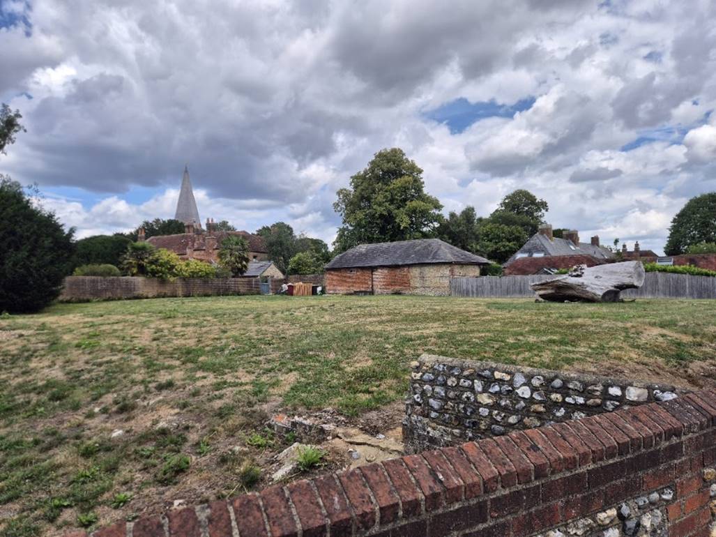
09 High Street
A special view from the High Street towards the shingle spire of St Andrew’s Church over an open space surrounded by buildings and walls constructed from the favoured local materials of red brick and flint.
10 Recreation ground
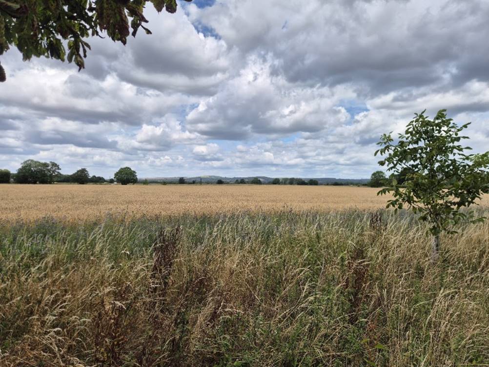
A characteristic landscape of different farmed crops, scattered or grouped lines of trees and hedgerows providing a suitable habitat for the local species of flora and fauna.
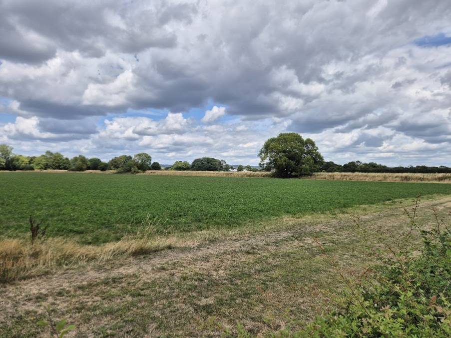
11 NE Oving Road
A peaceful and serene farmland expanse creating a significant buffer between Oving village proper and developments to the west.
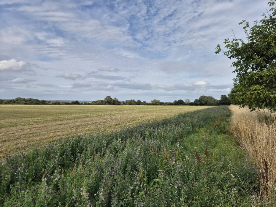
11 NW Oving Road
Bounded on three sides by roads and to the east by Oving village this land offers an important corridor for wildlife.
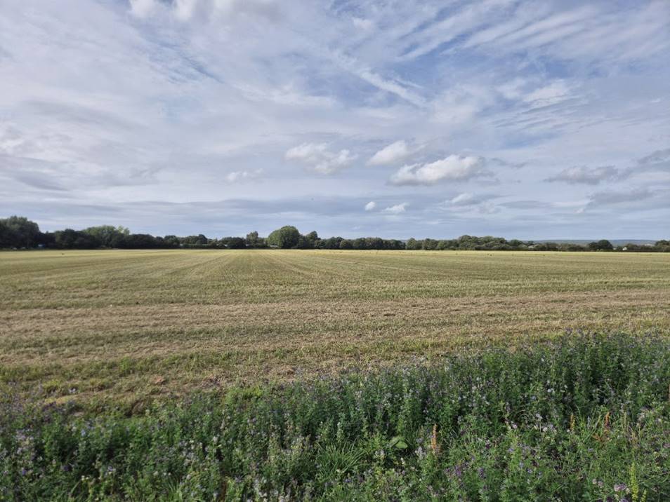
12 NE Oving village
A typical panorama of the landscape surrounding and protecting the essential character of Oving village with the church spire glimpsed in the background.
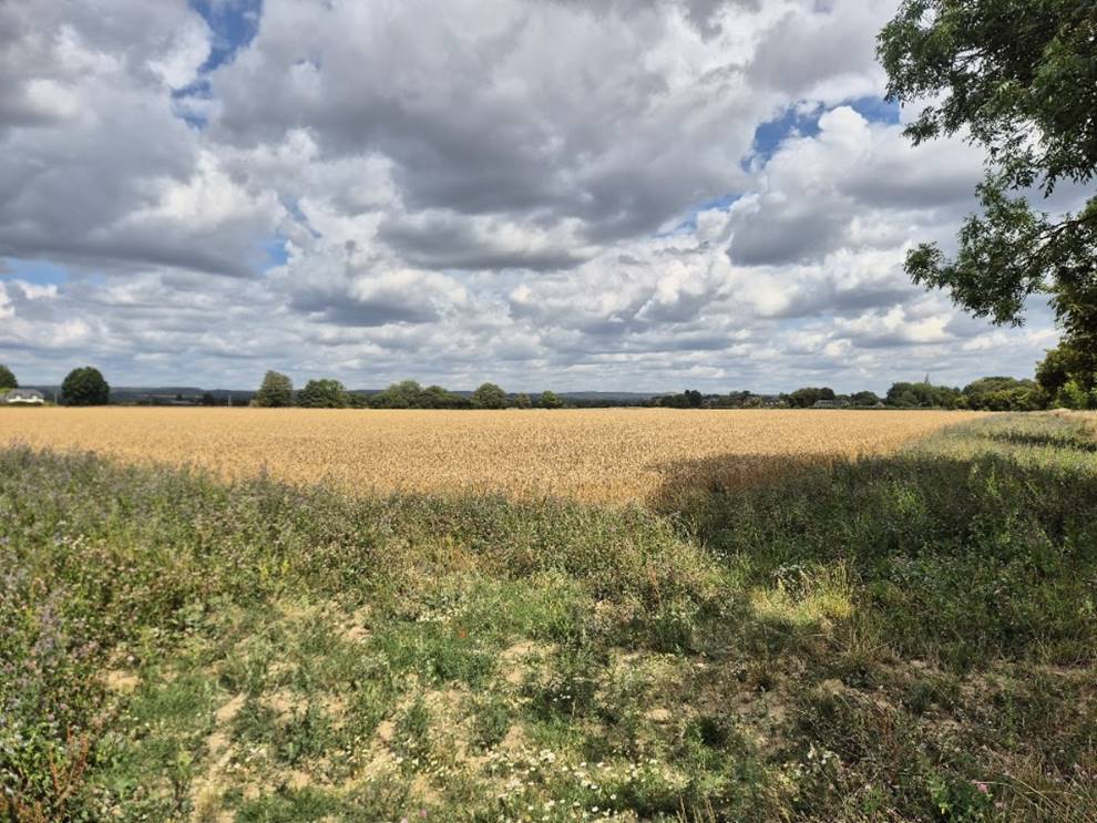
12 SE Oving Road
The view to the south of Oving village showing the extent of farmed land and the opportunity for wildlife to prosper.
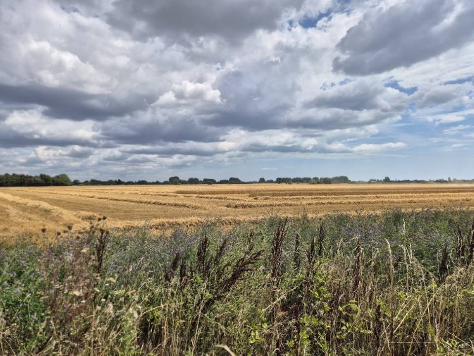
13 Oving Road
The approach to Oving from the east is bordered by well-managed farmland and an avenue of trees which establish an identity to be associated with the parish.
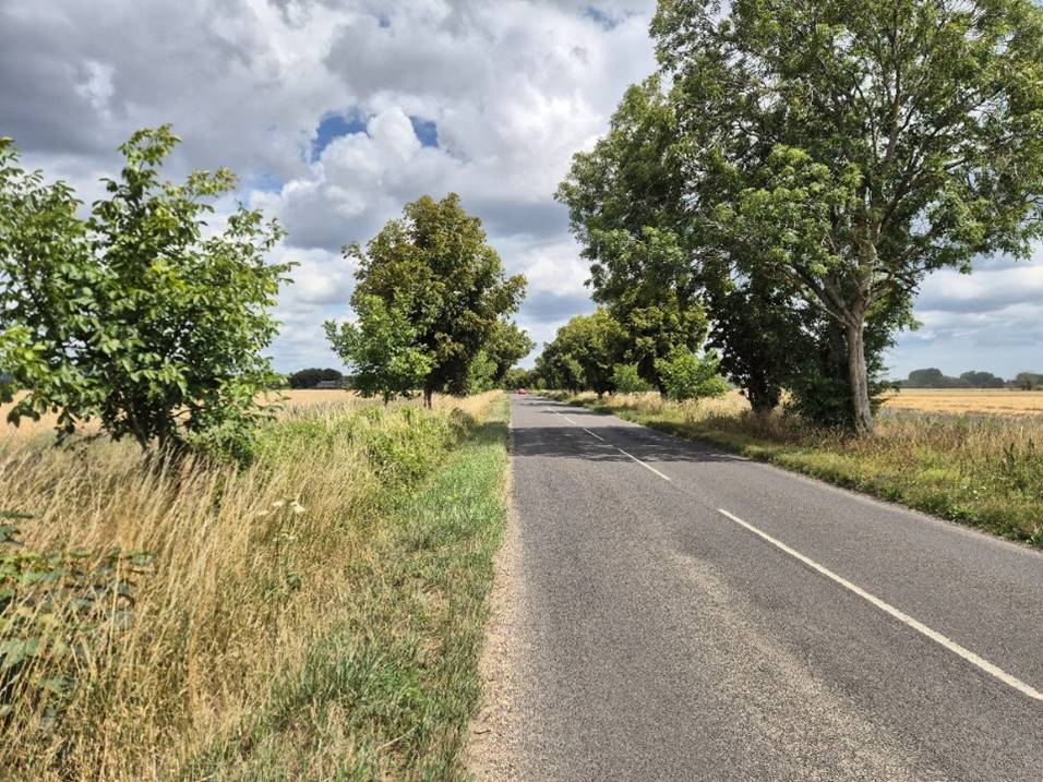
14 Oving Road
Seen from a convenient curve in the road when approaching the village from the east, the panoramic and extensive view of the landscape contributes to the image of Oving village as being surrounded by open countryside.
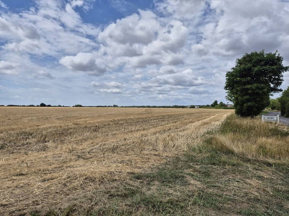
15 Oving Road
Large and small fields are characteristically bordered by mixed hedging, including trees, which create a rich and safe habitat for livestock and wildlife.
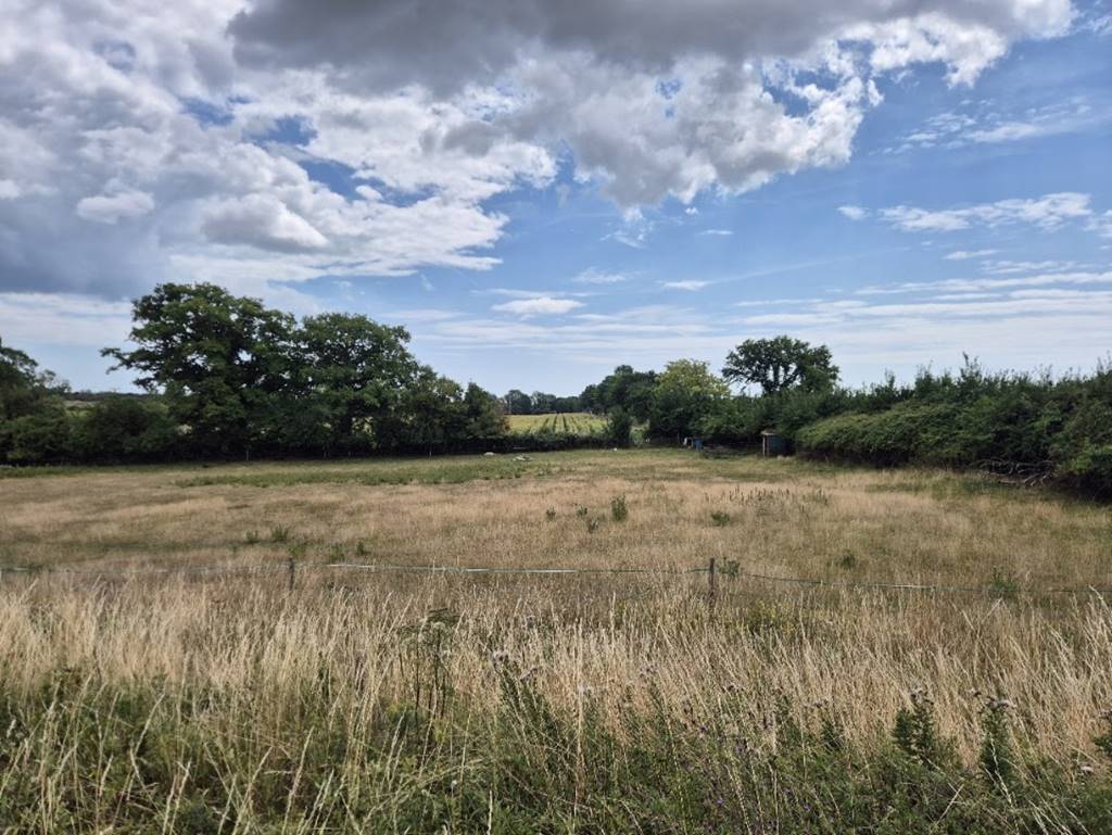
16 Footpath 277
Close to the railway line, a safe and frequented footpath.
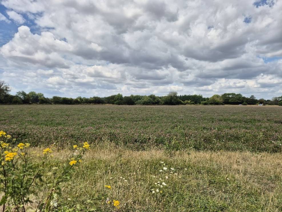
17 Railway NE
Rail passengers have an uninhibited view of the landscape of the parish of Oving.
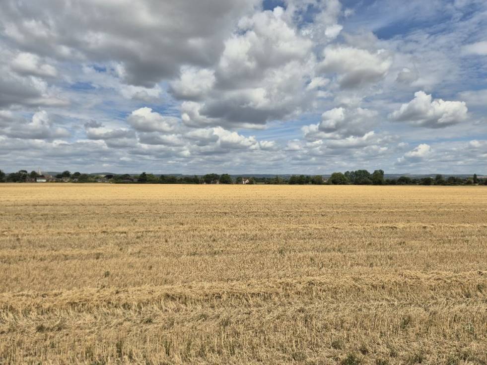
17 Railway NW
Users of the railway can enjoy and appreciate the long views over the countryside to be associated with Oving Parish.
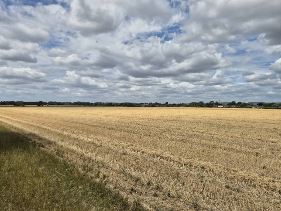
18 Colworth Road
The nineteenth century railway bridge affords an elevated view of the landscape including Chichester Cathedral in the far distance.
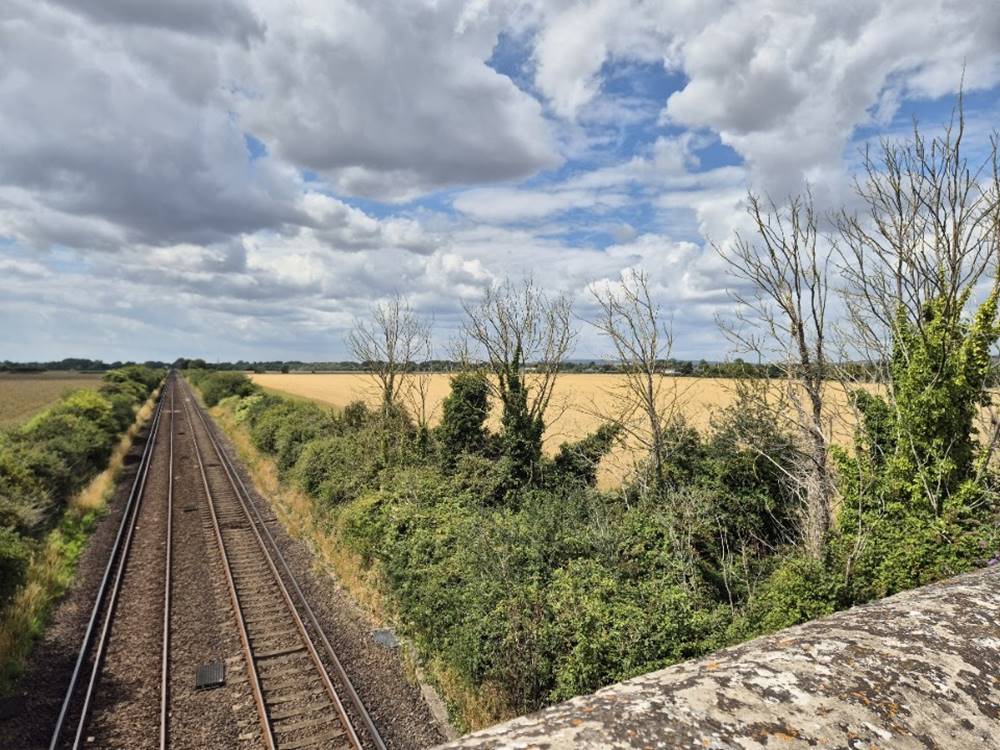
19 Footpath 287
Expanses of farmland, hedgerows, trees, ditches, set-a-side borders and scattered housing with distant views of the South Downs National Park exemplify the visual unity and identity of the local landscape.
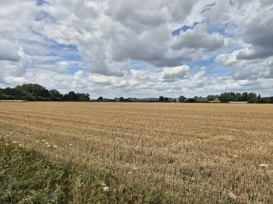
20 A259
Agriculture, horticulture and a location where remains of the World War II ALG airfield at Merston can be seen, with St Giles medieval church visible in the distance.
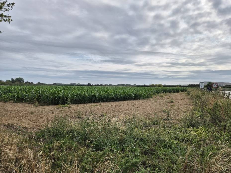
21 A259
Situated between two rifes with Abelands to the east and immediately left, probably originally church land, the view is over farmland towards Oving village with the South Downs acting as a horizon.
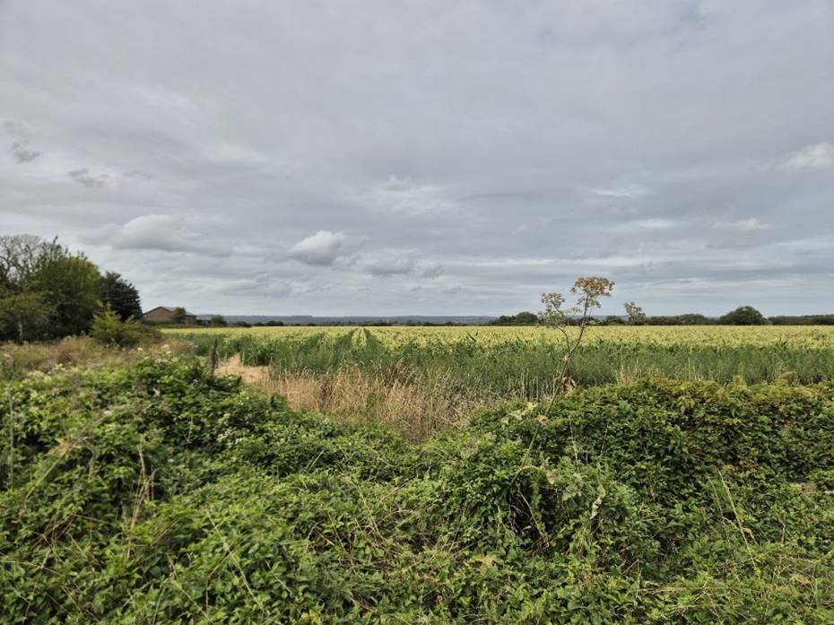
22 Colworth Road
Rich agricultural land with Oving village beyond the horizon viewed from the historic settlement of Colworth and the sunken Colworth Road.
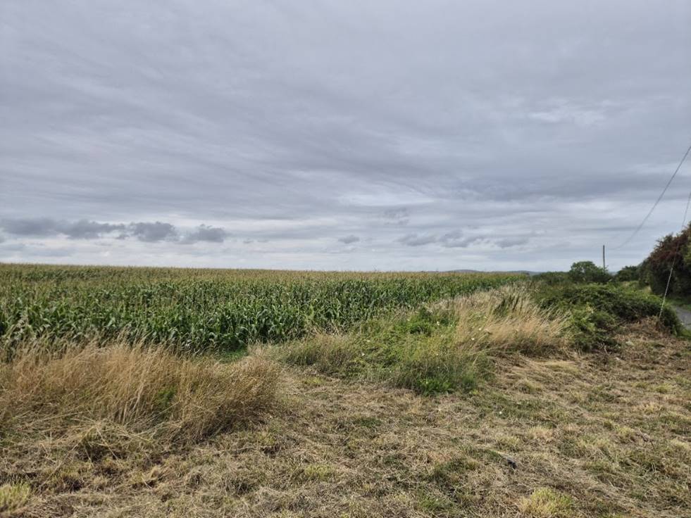
23 Colworth Lane
The parish viewed across open farmland from Colworth towards the church of St Andrew’s in Oving village.
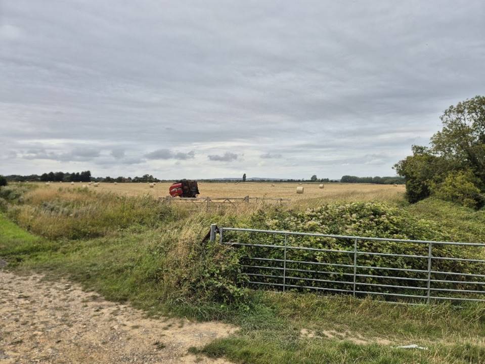
24 Footpath 220
A maintained and respected footpath close to the Parish boundary is representative of the green open spaces typical of the area.
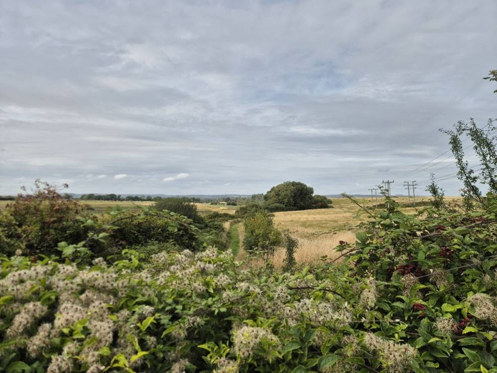
25 Marsh Lane
One of a number of small fields found in the unspoilt scattered settlement of Merston which supports a rich biodiversity of flora and fauna.
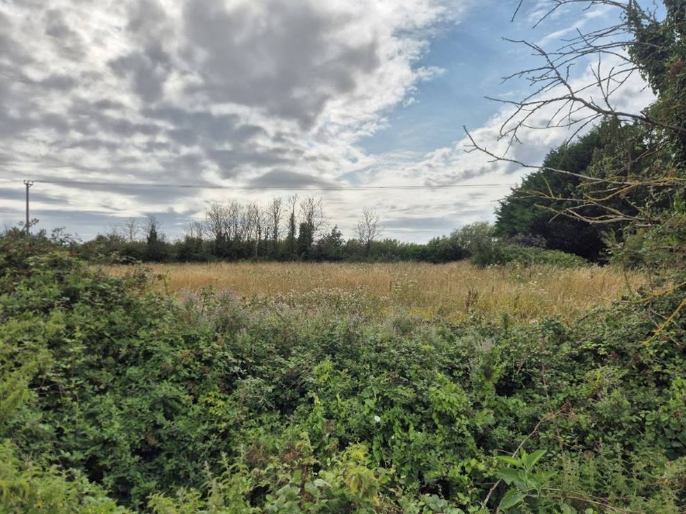
26 E St Giles Church
A view from the peaceful graveyard at the thirteenth century church of St Giles across fields which historically have included glebe land.
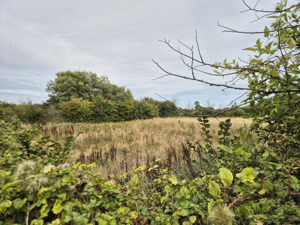
26 W St Giles Church
Farmland set between Marsh Lane and the course of the abandoned Portsmouth and Arundel canal seen from the slightly elevated graveyard across a small rife.
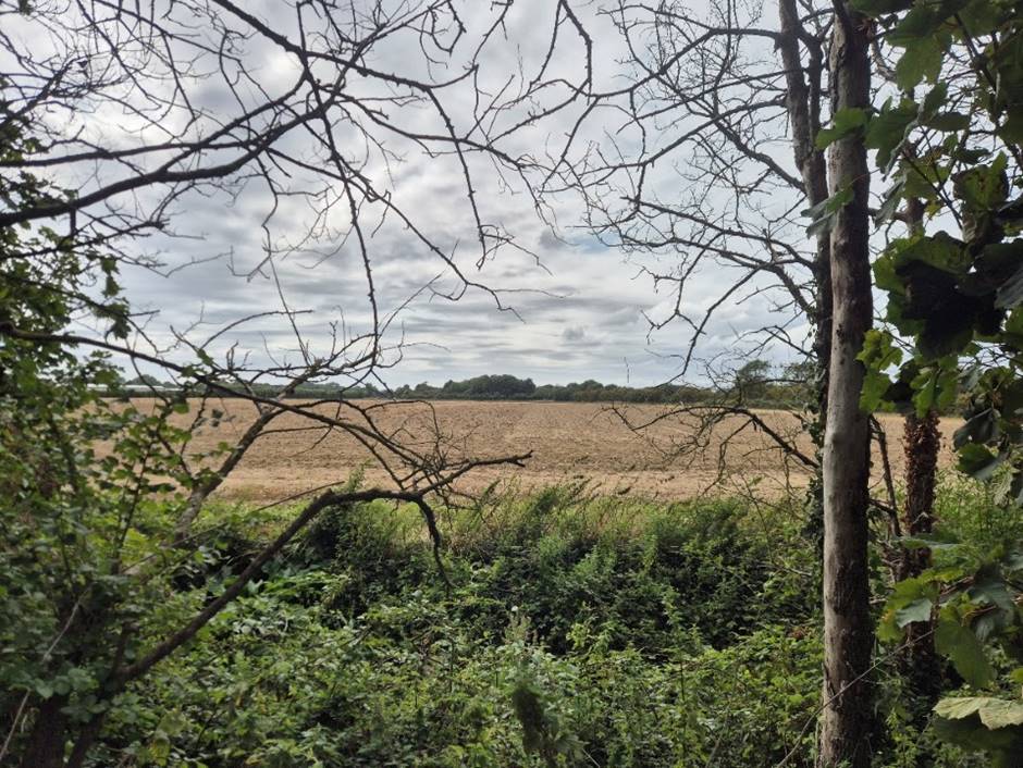
27 NW Footpath 200
An expansive farmland vista bordered by a footpath that follows the route of the failed Portsmouth and Arundel canal which still contains remnants of canal bridges and a detail of the towpath.
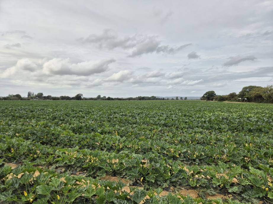
27 W Footpath 200
Looking west towards St Giles Church from the route of the local section of the once ambitious Portsmouth and Arundel canal.
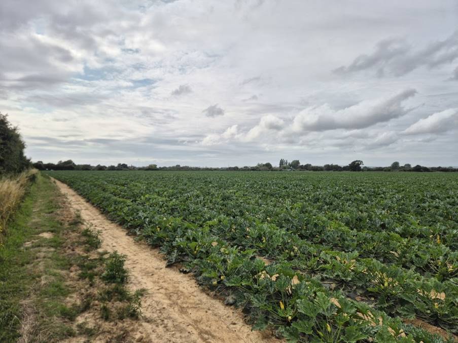
Appendix OV11 Heritage Assets List
• Mill House, Oving (value: historical, former mill house)
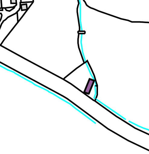
• Early Victorian cottages, 1-4 Merston Cottages, Marsh lane, Merston (value: historical/ architectural)
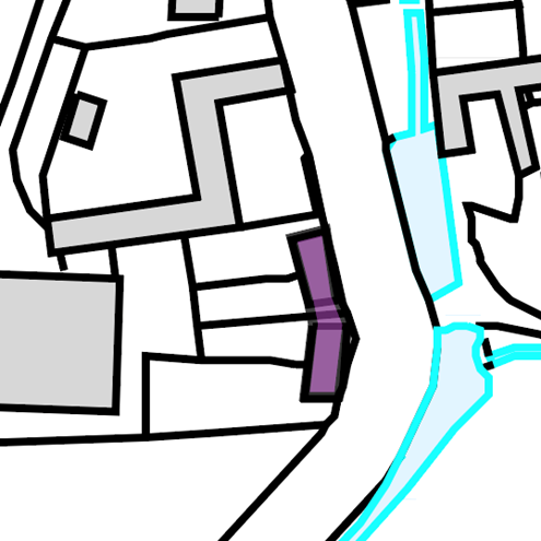
• The Mission Room/Chapel, Colworth. Originally a store, converted into mission room in 1883. Used as a schoolroom in WWII (value: historical)
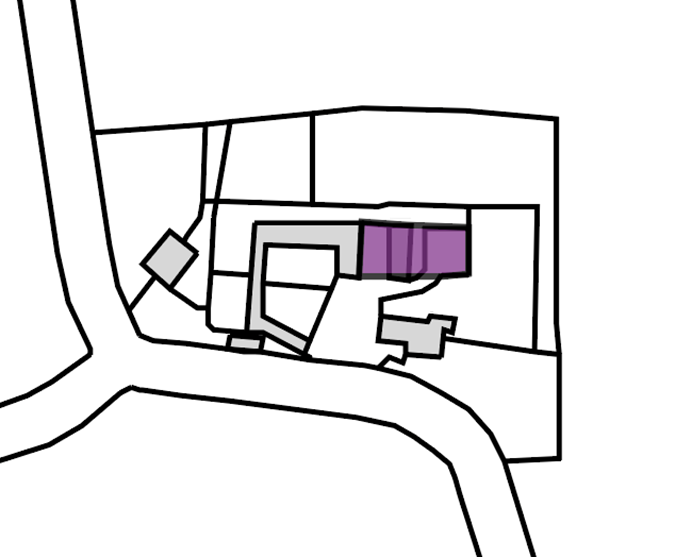
• Early Victorian cottages at 23 – 27 High Street, Oving. Excellent examples of the type with special features including Halsted metal windows. (value: historical/ architectural)
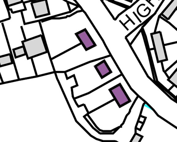
• Converted barns on corner of High Street and Church Lane, Oving. Recognised in Conservation Area Character Appraisal, retaining their rural architectural character (value: architectural)
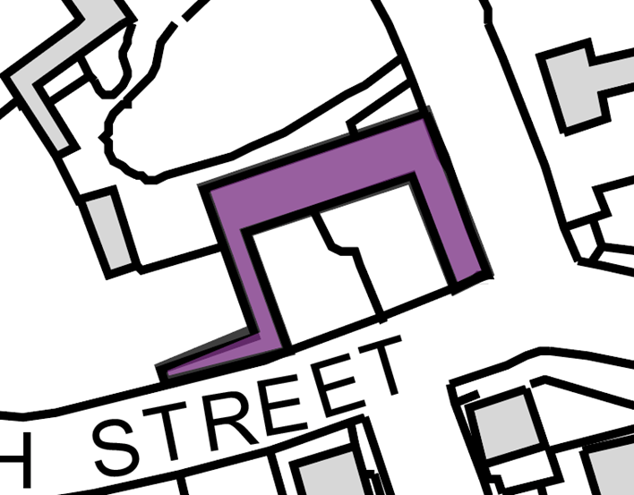
• Converted barns in Merston including Tapners Barn, The Granary, The Old Dairy and Stable Cottages (value: historical/ architectural)

• Single storey brick structures with clay tile pitched roofs at Madam Green Farm. Recognised in Conservation Area Character Appraisal as ‘notable and possibly as worthy of statutory listing.’ (value: architectural)
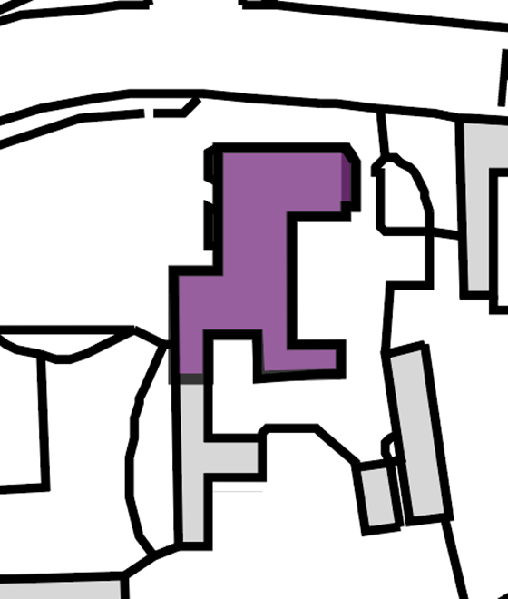
• Rushmans Cottage off Gribble Lane (attached to the listed Rushmans but not included in the listing according to the Conservation Area Character Appraisal though protected as part of the ‘curtilage’ of the listed building)
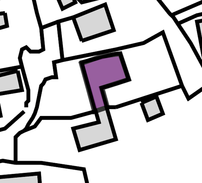
8. Maps
PDF copies of the individual policies maps are published in the evidence base.
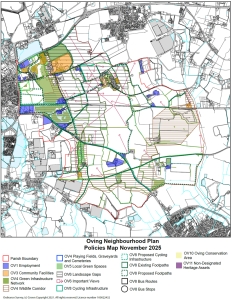
9. Evidence base
AECOM Oving Design Guidelines and Codes Final Report January 2022. Revised October 2025
AECOM Strategic Environmental Assessment for the Oving Neighbourhood Plan, September 2024
Historic England Advice Note 7 (Second Edition) HEAG301 Local Heritage Listing HEAN7
West Sussex policies-and-reports/roads-and-travel-policy-and-reports/west-sussex-walking-and-cycling-strategy-2016-2026/ https://www.westsussex.gov.uk/
West Sussex 2018-2023 Economic Growth Plan
The terra firma Consultancy Limited reports on Local Green Space and Oving Landscape Capacity, December 2021
Sussex Biodiversity Record Centre: Ecological data search for land at Oving Parish, December 15, 2021
Chichester District Council Oving Parish Housing Need Survey Report 2020
Chichester Housing and Economic Development Needs Assessment (January 2018)
Chichester Housing and Economic Development Needs Assessment (April 2022)
Oving Conservation Area Character Appraisal and Management Proposals (CACAMP) September 2006
Oving Village Character and Heritage Analysis Figure 13 (Chapter 2 ODGC)
‘The Setting of Heritage Assets: Historic Environment Good Practice Advice in Planning Note 3 (Second Edition)’ December 2017
Chichester District Council register of the Neighbourhood Area of Oving Neighbourhood Plan dated March 8, 2021
Hankinson Duckett Associates. Oving West Sussex Landscape Gap Assessment for Oving Parish Council, September 2024. Refined Area, October 2025